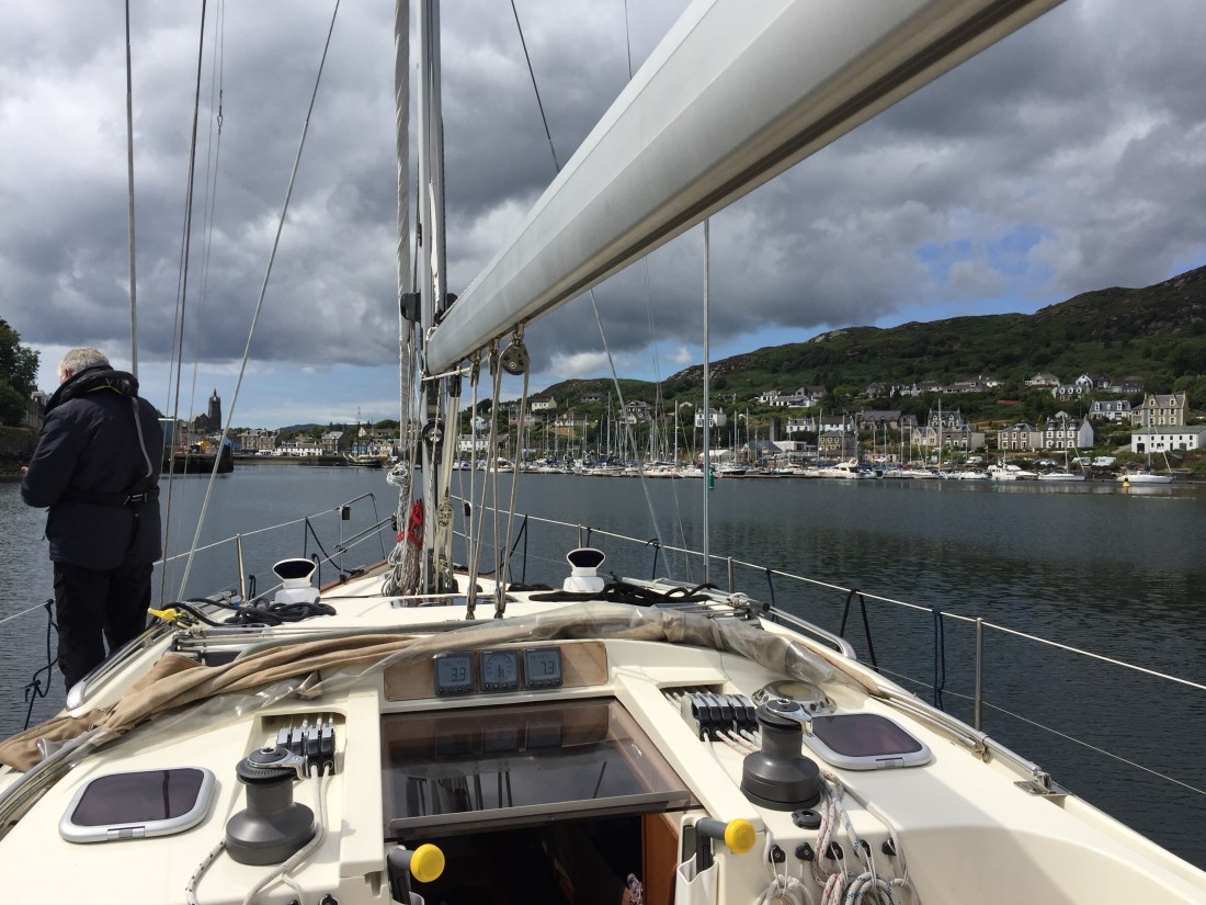
A grey, gloomy type of morning….. breakfast on board, quick trip to Tesco’s to ensure we had meals on board for the journey ahead, showers in the very forgettable marina facilities and prepping the boat for departure…. and the boat was ready to go at 10.30am.
Our departure from Douglas was determined by the time of the first lift of the road bridge over the channel from the marina into the outer harbour. This was scheduled for 10.45am… so we had to wait. Ahead of us was a 65-70 n.mile journey, a potential arrival of 9pm and thus a 10 hour stint out at sea. Not of our choosing and within a ten hour duration there would be at least two tides… and not necessarily in our favour. No road bridge and we would have left much earlier.
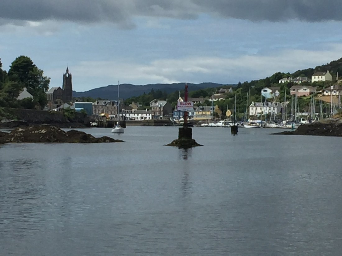
At just after 10.30am…. sitting in the cockpit twiddling with the ignition key… and suddenly, out of the blue, thick fog descended…. filling the valley with a thick, white wall of very limited visibility. The Port Control came over the VHF radio announcing the poor conditions beyond the harbour.
At 10.35am we started the engine in one metre of water on the berth…. so keel up, and we gently reversed out into the shallow channel. We arrived at the road bridge with two other sailing yachts maneuvering for an exit. 10.45am came and went… no action on the bridge… no alarms going off warning the traffic and pedestrians, no barriers coming down and no flashing lights.
Over the radio…. there had been a failure in one of the cameras and the technical people had to be called. So we waited….. holding 15 tons of boat at a point where a flood tide was coming in… is no easy matter… along with two other boats circling round behind and to the side of you. We finally made our exit at just after 11am from Douglas.
A thick wall of fog met us as we navigated out to sea using our electronic chart plotter and the blasts from our fog horn midway up the mast. The other two boats were on AIS and we could see where they were in relationship to our position. One of them played ‘silly buggers’ …. when we turned away from him, he would turn towards Poli Poli. This went on for about 15 minutes before we managed to lose him…. he went north up the coast, we went south west…. situation averted.
The fog bought with it…. freezing cold. Within the first hour, we had jumpers, scarves, gloves and hats on… extra coats as well. So from oily flat seas, blue skies, sunshine and temperatures of 30 deg… in the Irish Sea off the coast of the Isle of Man…. it was freezing! Was the heat wave over? Fog …. similar to that which we experienced between Poole and Portland Bill on the south coast. Along with the fog… no wind to move us by sail or to blow the fog away!
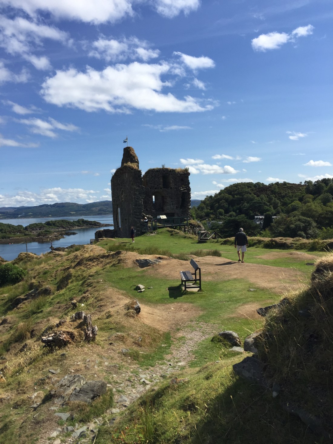
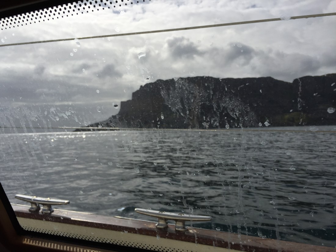
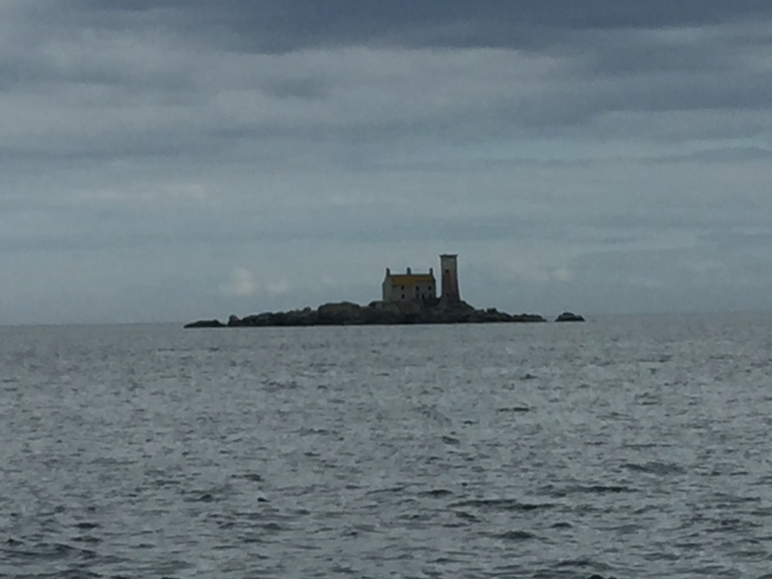
After three hours of thick fog, it lifted as quickly as it had descended… and revealed the towering Calf of Man lighthouse against a backdrop of the green, brown and black cliff landscape. Our last glimpse of the Isle of Man.
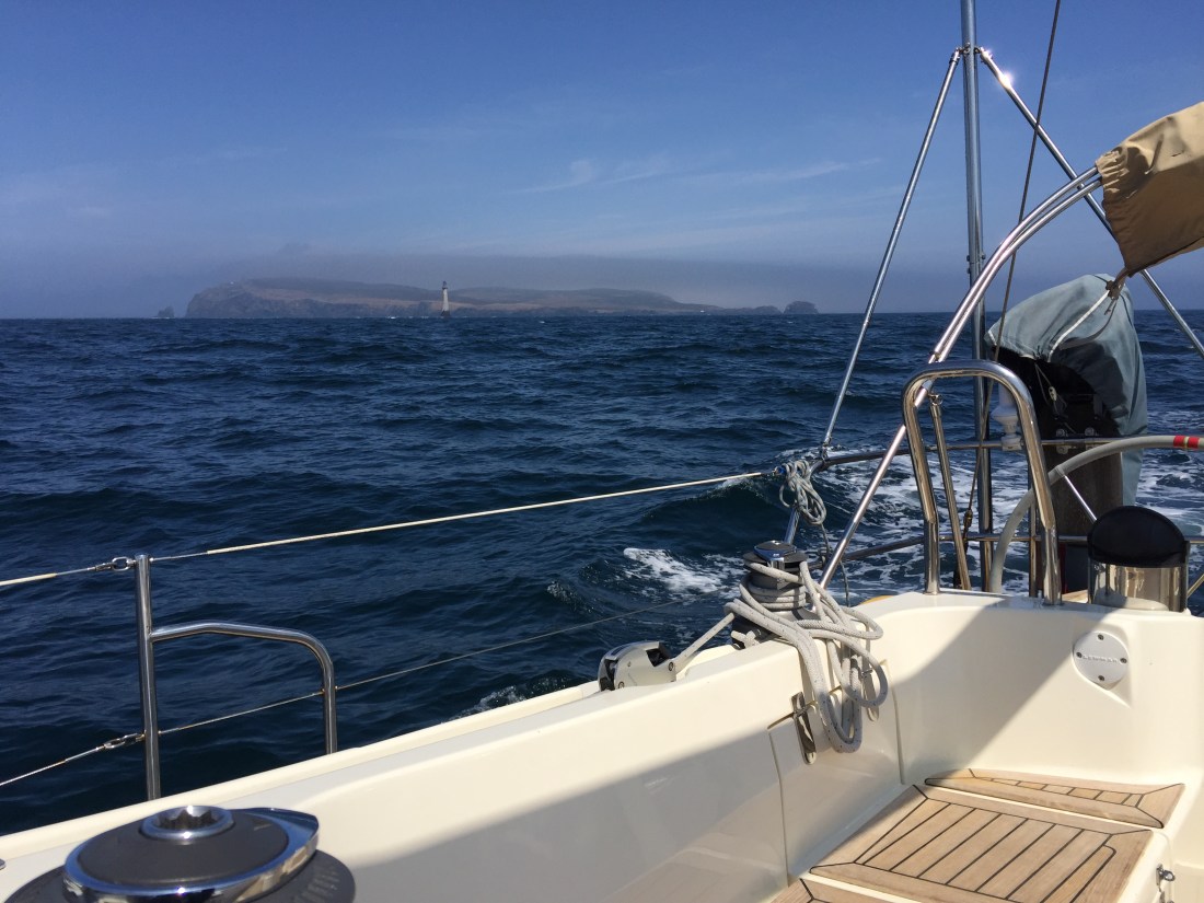
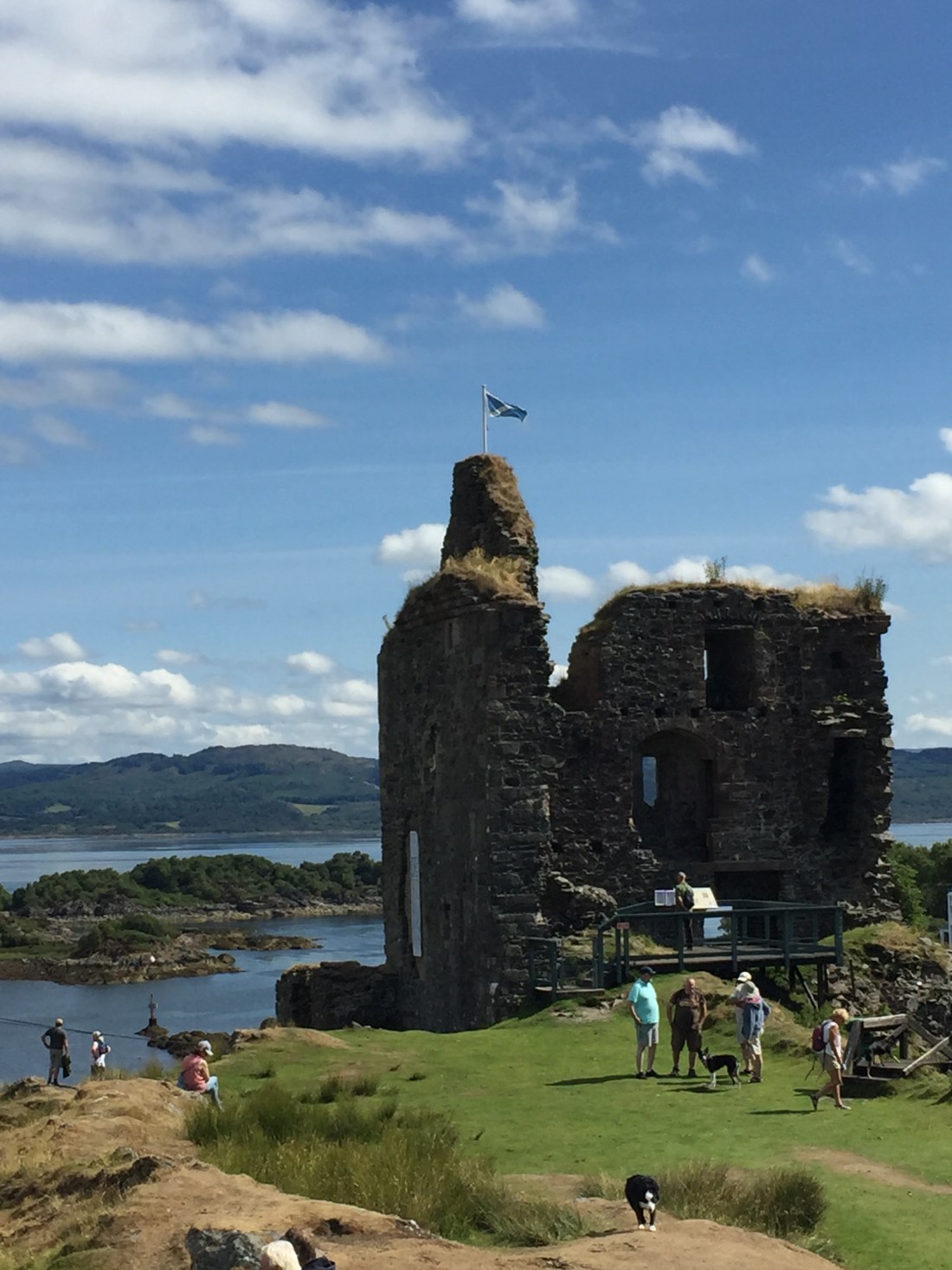
Photo …. The Calf of Man lighthouse set against the south western tip of the Isle of Man. Notice the blue skies. The fog has lifted.
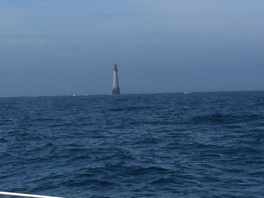
Our first view of the lighthouse at the Calf of Man. Spectacular.
The next few hours past without event. The wind described as ‘variable’ flickered all over the place at less than 7 knots. Useless for sailing…. so we motored on heading north west, slowly but surely eating up the miles at well over 8 knots of speed. Surely this could not continue?
Around about 6pm off the coast of Northern Ireland… we noticed a change. Our speed started to decline as the tide built against us. We were now head to tide. We had known at some point this would happen… we had enjoyed the benefit earlier on of a following tide, now it was turning coming at us from north to south. Our speed fell to just 6 knots and occasionally just over 5 knots.
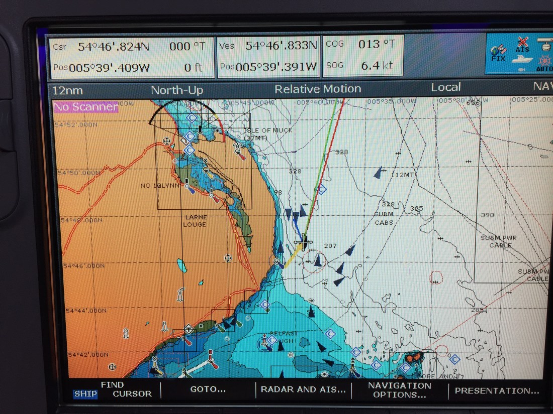
Our route took us NW around the top of the three big islands known as Copeland, Lighthouse and Mew into Belfast Lough and then to Bangor Marina. You either went through between the islands into the Belfast Lough, which was the quicker route, or the very long way…. all around the top…. possibly an extra two hours onto journey time. A decision had to be made… between the islands or around the top?
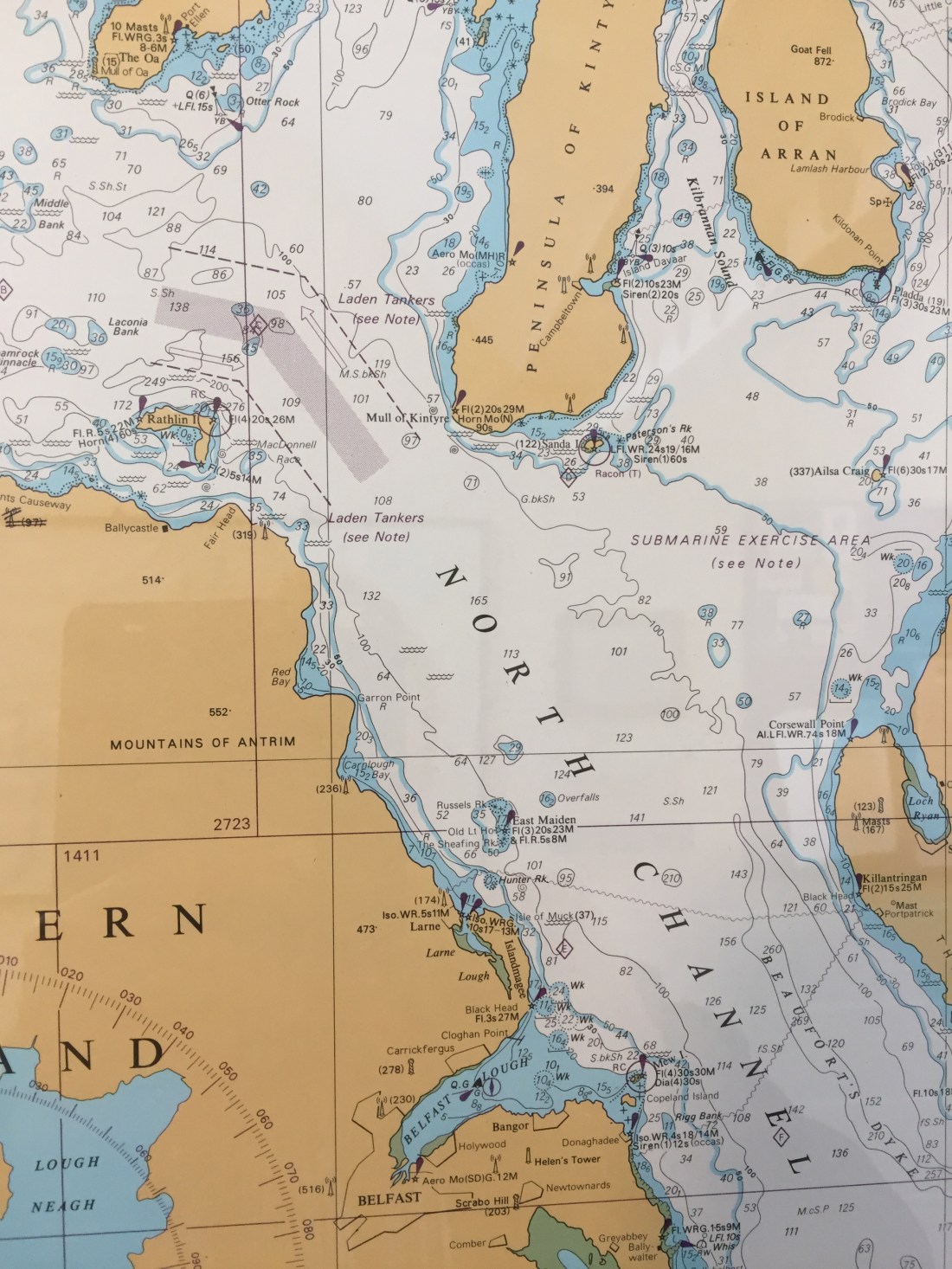
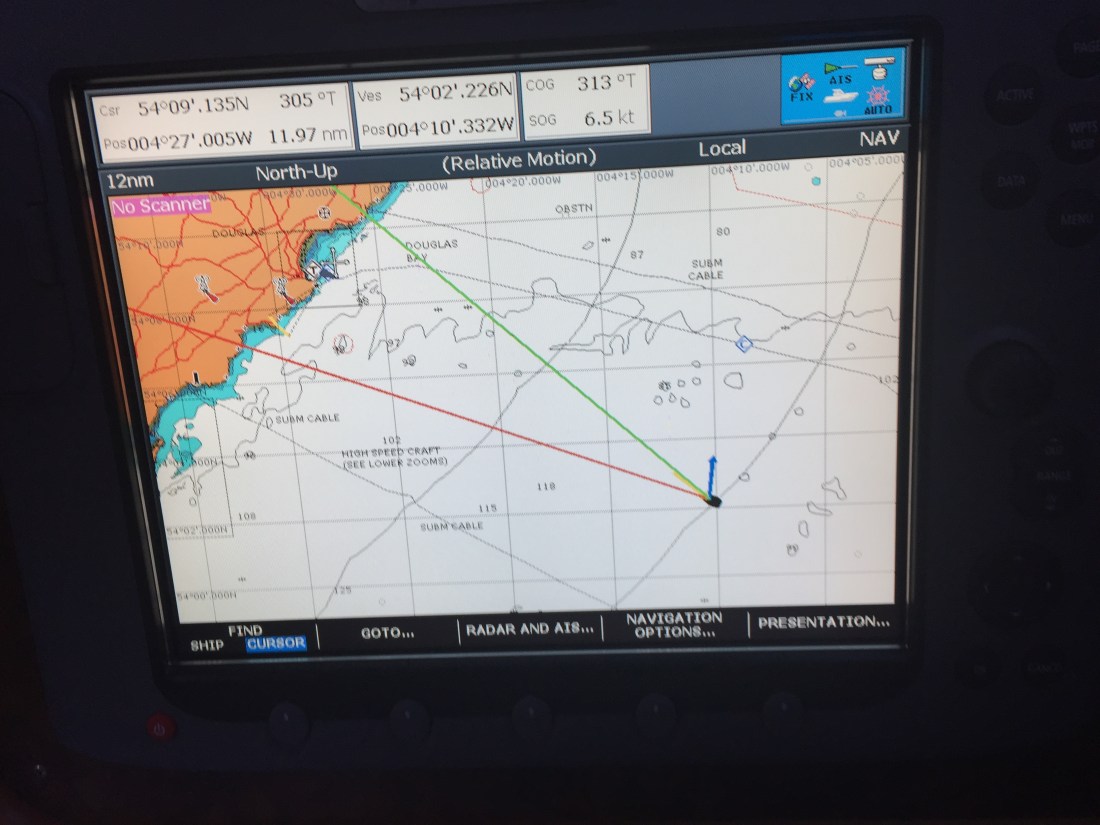
Chart above… find the Belfast Lough in the bottom right. We are coming up from the south east. Note the three little islands near the double ‘N’ of the word Channel. These islands guard the southern entrance to Belfast Lough. Note the position of Bangor to the east of Belfast.
Looking at the oncoming tides rushing south it would all be about a matter of timing. Low water between the islands was 7.11pm… then the tidal race through the gap would start running, and it would run for six hours.
The decision taken …. to go through the gap between the mainland and Copeland Island… known as the Donaghadee Sound… was based on the assumptions that
(a) it was a buoyed channel with two reds and two greens. This helped to fix the route of travel as well as to indicate deeper water.
(b) If we could arrive at about 8pm… then only the first hour of the tidal race would have started…. giving us the best opportunity of getting through. The rule of twelfths applies here….in the first hour of the six hours, the speed of the tide runs at one twelfth, then two, then three… and then three again and finally in the last 2 hours, 2 twelfths and finally one thelfth and slack water. Pass through the gap any later and we would be faced with 5 knots of oncoming tide. Best remembered as over the 6 hours… learn ‘123 then 321’…. vital to know this.
(c) Go round the outside of the three islands and the extra time taken would mean facing the middle two hours of oncoming tide…. even more dangerous than crossing the gap at low water plus one hour.
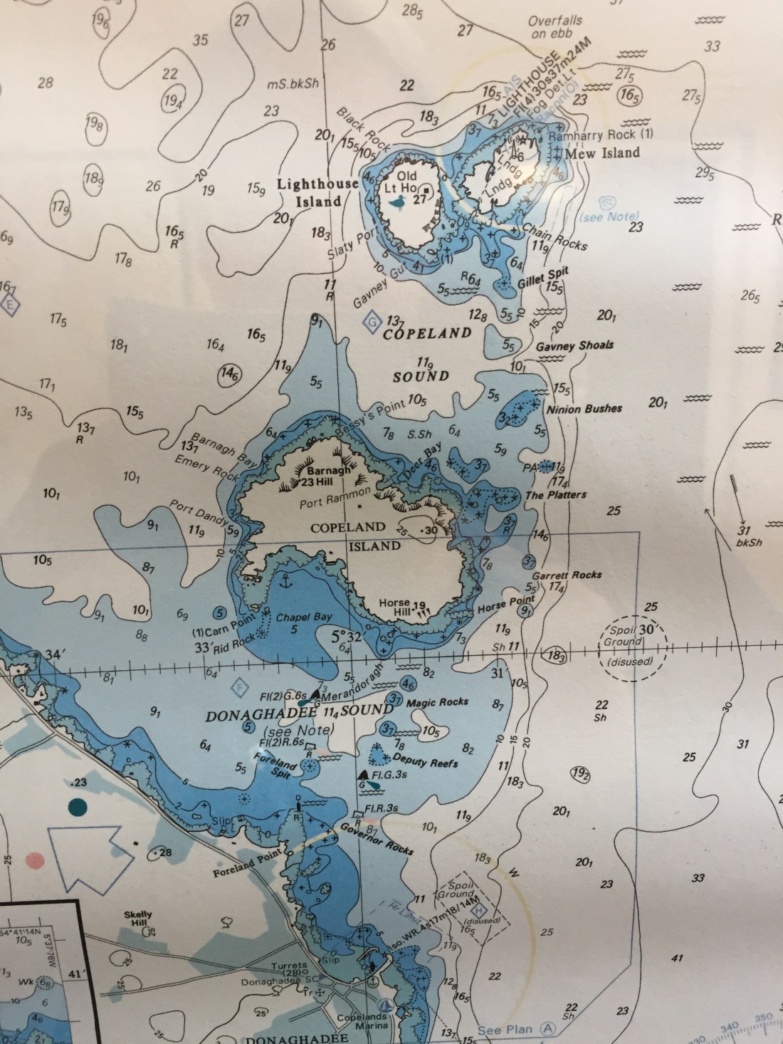
Above is a close up of the Donaghadee Sound. To the south west is the mainland and to the north is the island of Copeland. If you look closely you can make out the four buoys. Notice all the ‘threats’ … Governor Rocks, Deputy Reefs, Foreland Spit etc etc.
We also had to maintain our speed,….. so up came the keel to reduce the resistance to the tide by minimizing our profile. For a while, as a flat bottomed boat, this worked well although we had to put up with a rolling motion.
At the first pair of red and green buoys our speed was 5 knots…. by the time we passed the second pair our speed dropped to below four. The onrushing tide pushed against the boat, but our speed held up. A few anxious moments yes…. but Poli Poli punched her way through the tidal race and out into the deeper water and the lesser tide of Belfast Lough. We had crossed the Donaghadee Sound… and today was ‘Springs’ …. the significance of that has been explained previously.
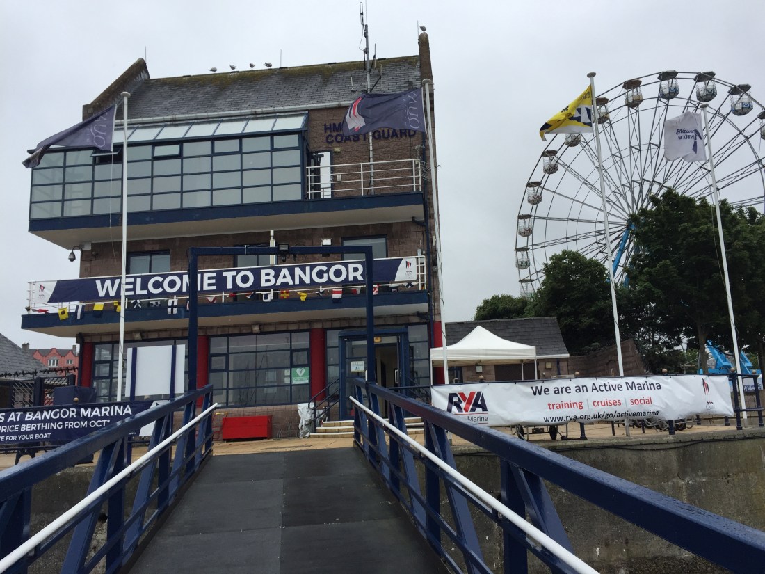
We rounded the north cardinal at South Briggs off Orlock Head at 8.35pm …. safely into Belfast Lough…. then we turned westwards and berthed in Bangor Marina by 9.30pm. The Salty Dog Hotel beckoned…. fish and chips washed down by the new lager from Guiness. A long, long day with a bit of angst towards the end.
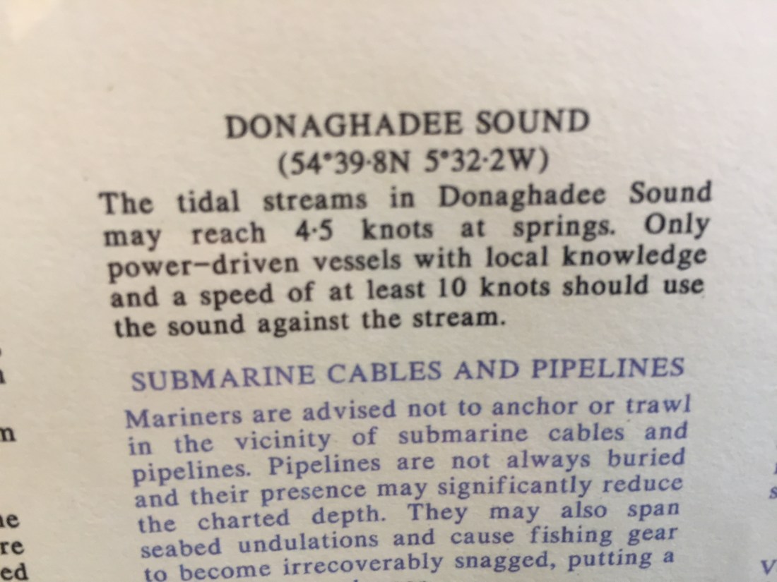
I saw the above in Bangor Marina …. in a corridor outside the loos. The four to five knots refers to that middle section of the six hour tide rise ie the 123321…. the two threes. You have to work out the exact time that these two 3’s occur. Then don’t go there!! We crossed in hour one….. with abit of hour 2.
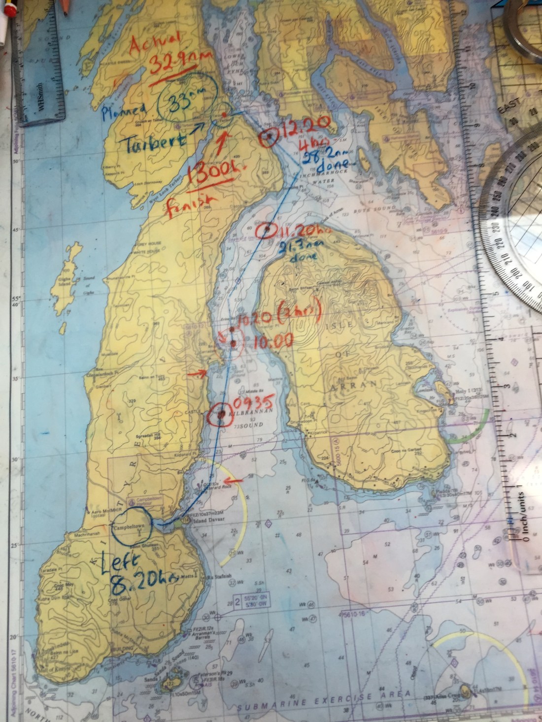
Total mileage for the day… 74.30 n.miles.
Duration: 10 hours.
Distance from Eastbourne: 1,226.3 n.miles.

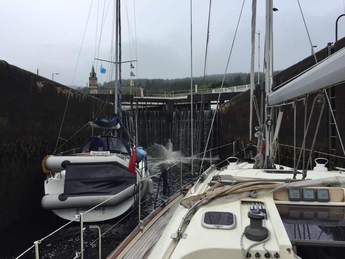
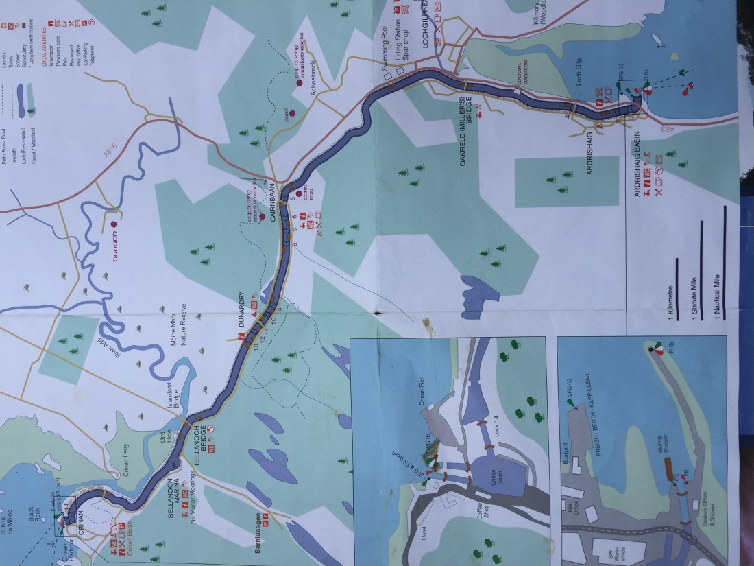 We are currently moored above lock 14..above the Crinan Basin and have talked to the Canal folk who say they will make a decision at 1pm today. Fingers crossed they will let us plus two other boats out to sea. So no phone signal and in limbo!!
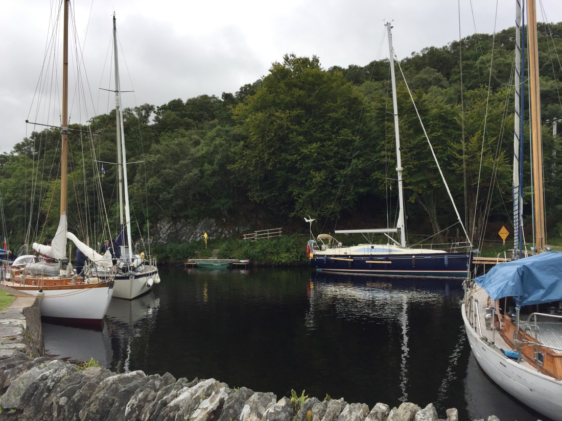
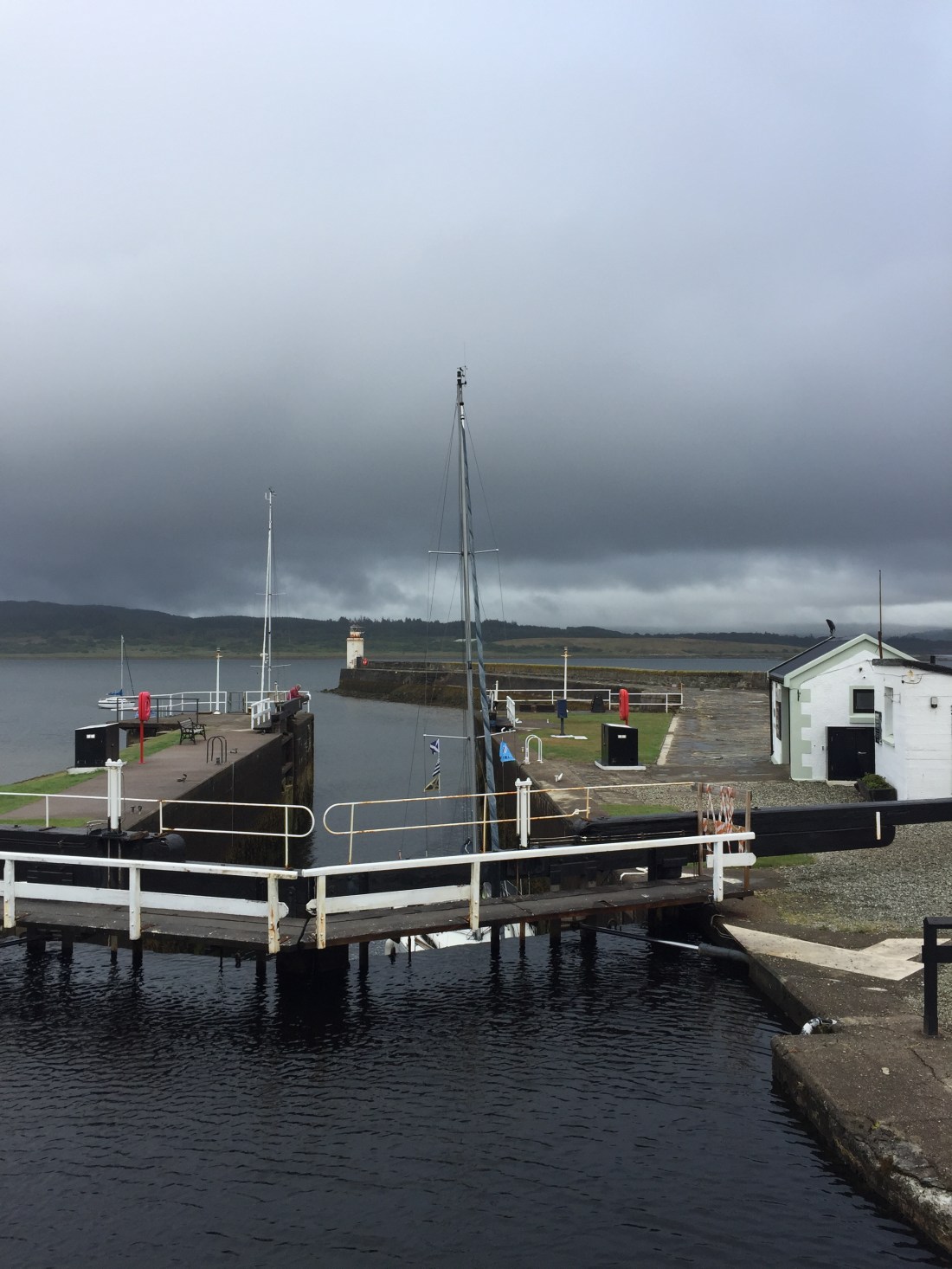 The other side of the white gates…a big drop down is the sea lock at Ardrishaig. When we arrived there was one other boat in the sea lock…with a baby on board.
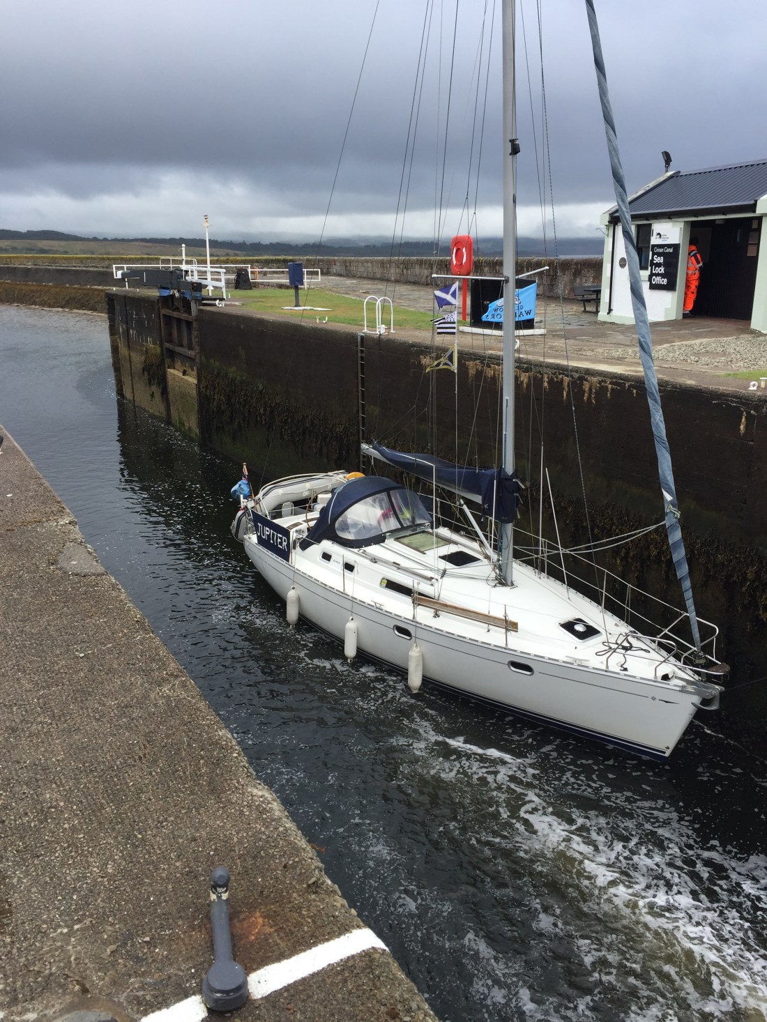
 Poli Poli tied up to the waiting pontoon outside the sea lock. We had to wait a long time …we arrived at the sea lock about 11.45am but the first sea lock was scheduled for 2pm.
 Poli Poli in the sea lock with Jupiter…baby aboard!!
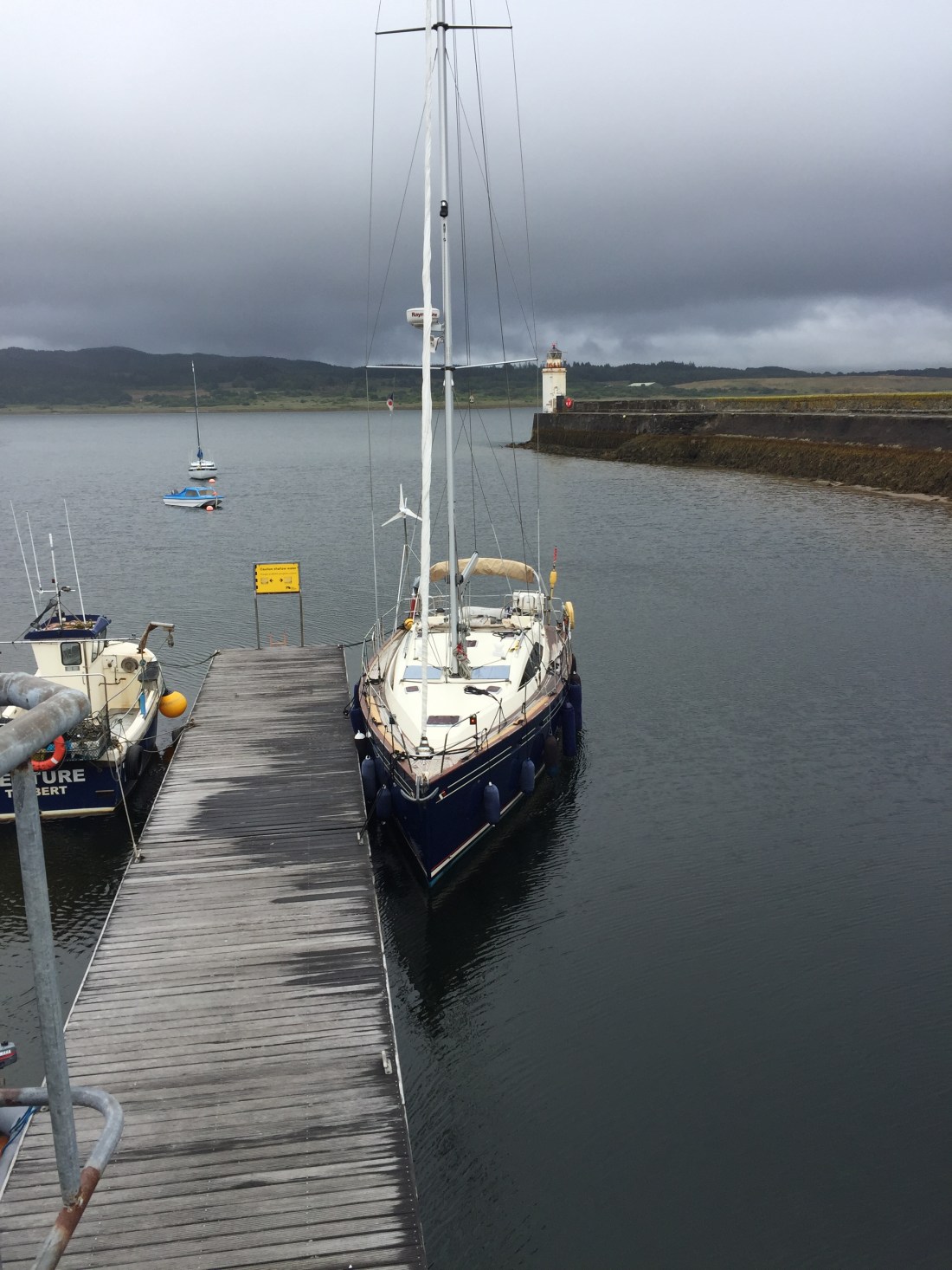
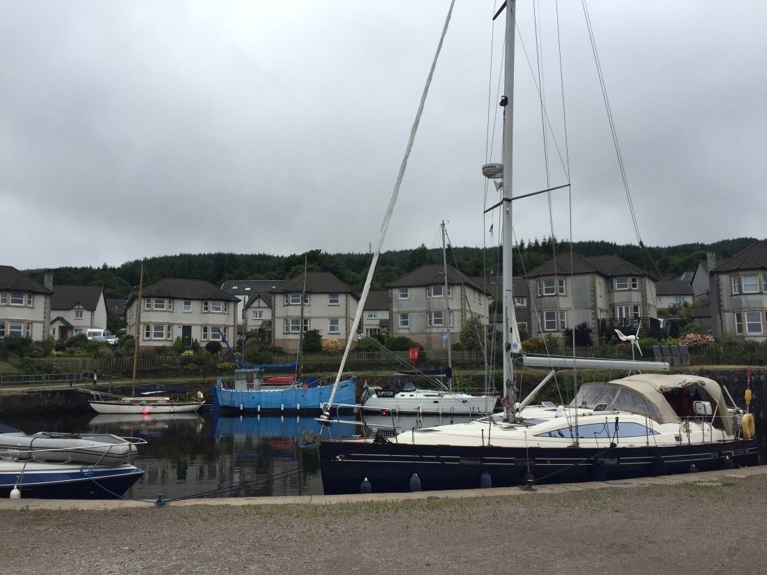 Poli Poli moored up against the wall in the canal basin at Ardrishaig. The cockpit tent has gone up to try and dry all the sodden, wet oilies!
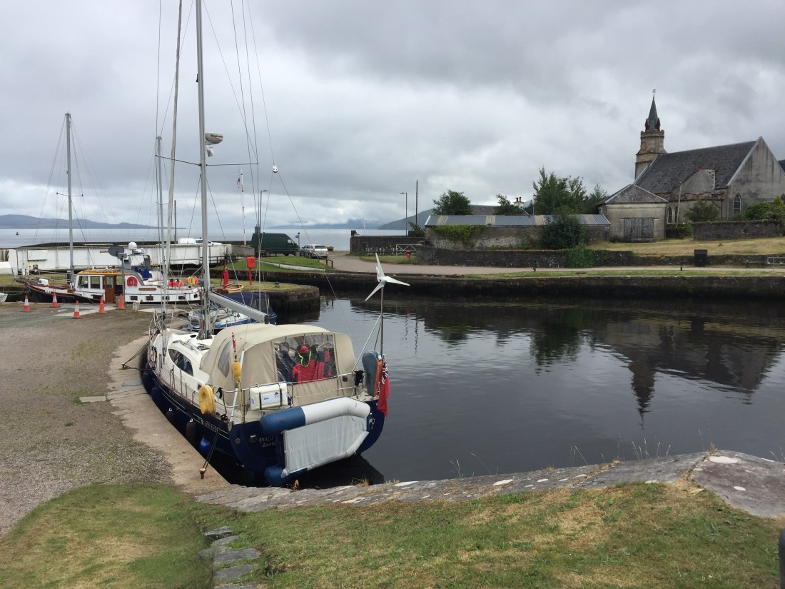 After visiting a local hotel for refreshments…we returned to the boat..and in no time at all a French boat had decided to raft up against us . Three retired gentlemen from Brittany.


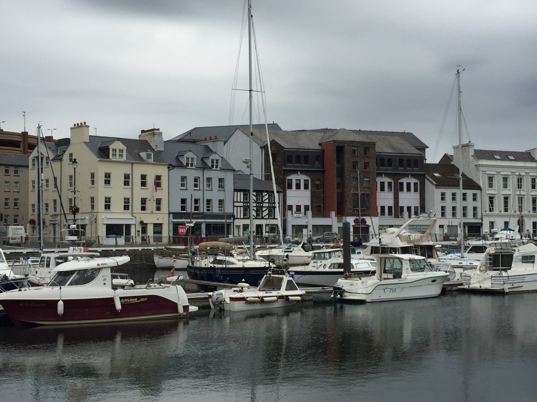
 A warm, sunny day…. some forecasters were now talking about the end of the July “heat wave” in the north and north west of the UK. We will see. The standard “rest day breakfast” taken in the main shopping street of the capital, Douglas. Not brilliant… no comparison to the one in Liverpool or Conwy…. but satisfactory …. they had run out of English Mustard!! Not a good start.