

There has always been a great deal of advice for sailors who have contemplated sailing up the River Thames…. which is good…. and useful if not at times, conflicting. In the end you have to trust your own judgement. Poli Poli has sailed previously up the Thames to Saint Katharines Dock by Tower Bridge… in 2015, which is only three years ago…. so not too difficult to recall the “lessons learnt”.
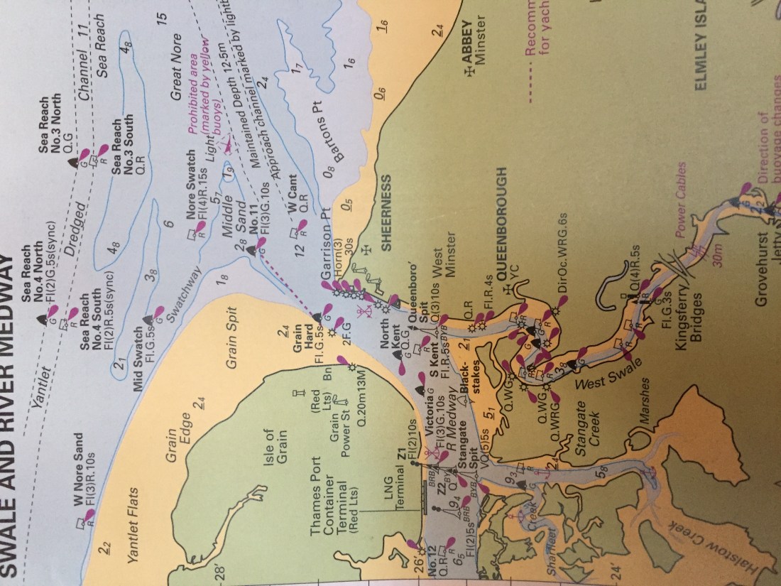
Please turn map the right way up. This shows the Medway area at Sheerness.
Last time our starting point was Chatham Marina on the Medway river… some 2 hours from Sheerness and the Thames Estuary. This time our jumping off point would be Queenborough, much closer to the actual channel up to London. So recalling all the advice… in summary … start at the turn of the tide….ie Low Water Sheerness and the flood will carry you most of the 40 n.miles up to Tower Bridge. From another source…. make use of the last hour of the ebb tide… and you will then have seven hours of fair tide into the heart of the City.
We did the latter, departing Queenborough …at 5.40am … saying goodbye in the dark to the “Spirit of Sheppey,” our rafting up day tripper boat… and headed out to the East Cardinal buoy near the confluence of the Swale and Medway. The ebb tide was running and it carried us quickly out into the Medway shipping channel.
Sticking to the left hand side of the channel, we followed the greens and then did a sharp left turn just before the wreck of the Richard Montgomery. All of this took place in the dark!
The plan was not to go all the way out…. easterly… to the Fairway buoy and join the Thames deep water channel there… but to use one of the local “swatchway” channels through the many and varied sandbanks. We utilised two lit buoys to achieve this… the Nore Swatch red and the green Mid Swatch. As we did so we passed the infamous Nore sands…. upon which the Robert Montgomery broke her back way back in 1944.
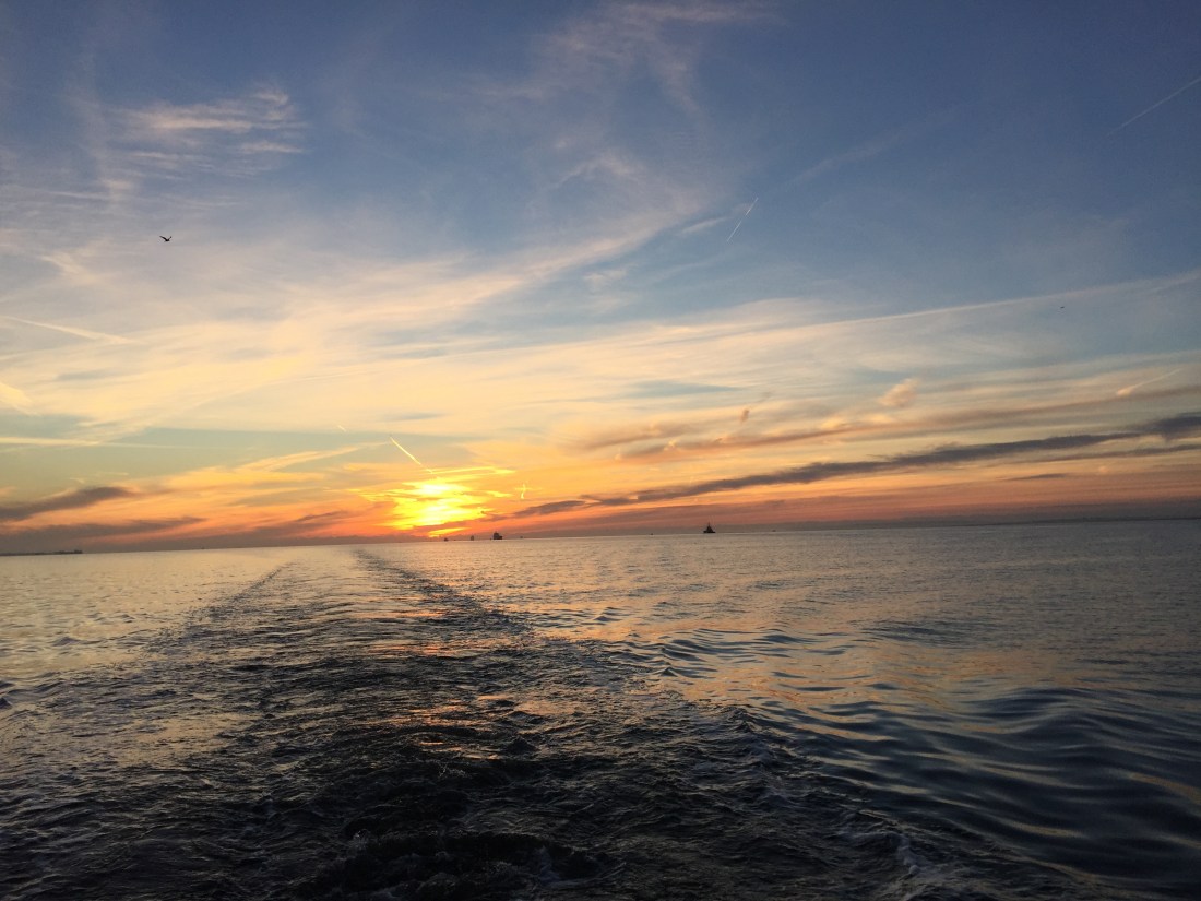
Once we had arrived at the deep water Thames Channel, we crossed at right angles and then followed the greens on the north bank of the Thames…. all the way. That is the rule… stay on the right of the shipping channel and avoid all commercial shipping. With the final knockings of the ebb tide we were still making over 6 knots ….. motoring. There was very little wind… a breeze from the west of about 5 knots.
Having joined the shipping channel at Sea Reach No 6 green buoy…. to the west of Southend on Sea…. we were then treated to a spectacular sunrise immediately behind us…. probably more impressive than the one at Shotley.
Below you can see the wake track of Poli Poli ..and the sunrise behind us. Taken on the starboard side of the Thames deep water channel heading west.
 So Leigh on Sea passed us by on the starboard side…. the light now revealing the coast line on both sides of the estuary. On the port side….another MOD firing range… could not quite understand why so close… located on St Mary’s marshes. Various large ships lined up behind us…. obviously vacating the overnight boat park … dredgers, container ships, oil and gas tankers and all manner of tugs towing huge barges. From an empty estuary by 7am the deep water channel was buzzing with ships.
London Gateway port …. Canvey Island had three enormous container ships moored up… being either loaded or unloaded by giant cranes that looked like bent stick insects.
As we passed below the ships, we watched the crane operators working hundreds of feet about the great piles of containers… moving them up, down, back and forth. One of these vessels kept being mentioned on the VHF radio “London VTS” … as an “exceptionally large container vessel… the Savannah” ….something?…..as she was making ready to depart.
After the giant cranes and piles of containers…. came the opposite… the “Mucking Flats”…. open countryside and as it was now low tide, vast expanses of black mud… with shrieking gulls criss crossing the flats.
Once round the big bend at Lower Hope, the Kent town and riverside port of Gravesend opened up. From here onwards up to and beyond the Queen Elizabeth Bridge and Dartford Tunnel.. the riverside becomes very industrialised both sides. We were disappointed that, having scoured both sides of the river with our binoculars, not to see any evidence of Benny the Beluga Whale …. allegedly trapped between Gravesend and Tilbury. The latter, plus Grays, Purfleet and to a certain extent Greenhithe… present an untidy mix of industry and better times eg the London Cruise Terminal at Tilbury ( empty and folorn ).
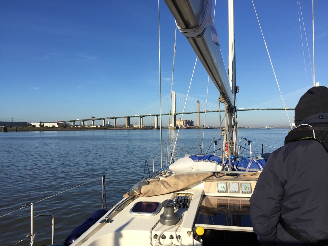 In bright warm sunshine now, we passed under the enormous expanse of the Queen Elizabeth Bridge. ( photo above ) …. arching above us…. no problem with worries over air draft. You could probably have fitted four if not five Poli Poli type yachts on top of each other and still had space to spare…. looking up it was difficult to imagine that there were six lanes of traffic overhead on the M25.
Dartford merged into the Cray marshes…. then came Erith and its yacht club on the south side. Essex popped up on the other with a sorry looking closed Dagenham Ford works plus their enormous land fill sites camouflaged to look like empty countryside. Only the breather pipes for the methane gases underneath to escape…. are the give away.
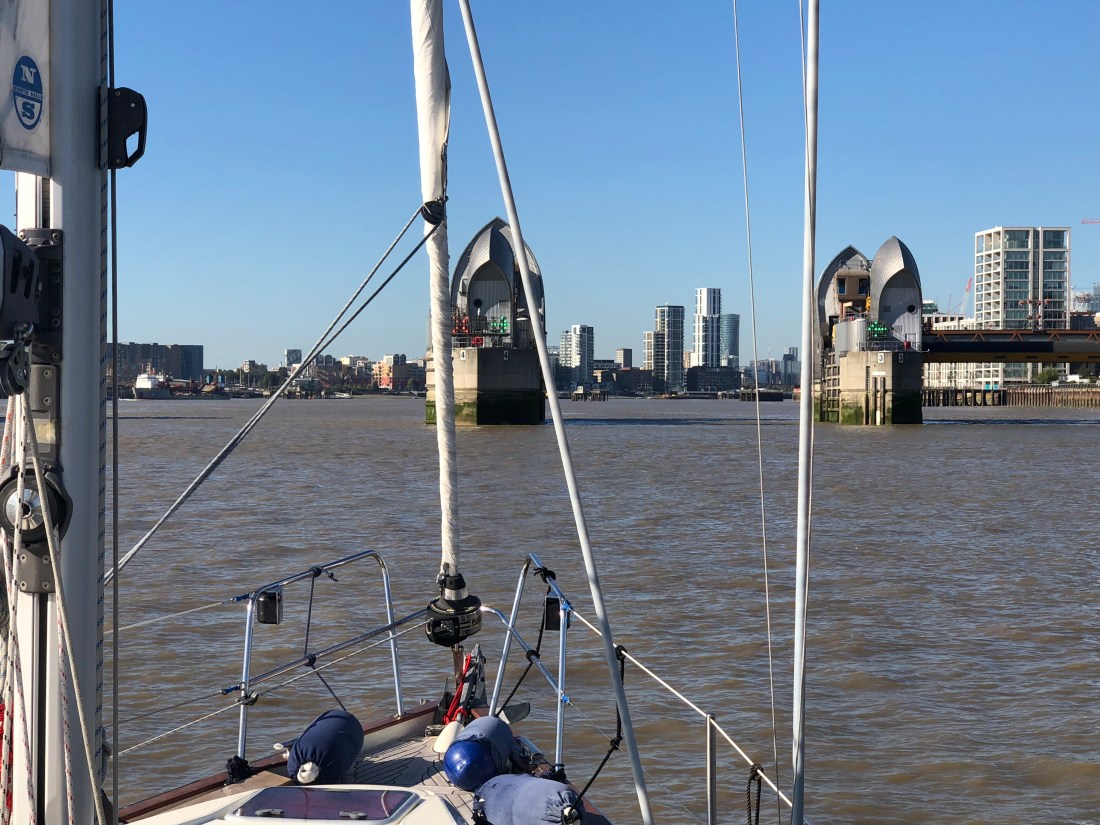
At a point just after the Barking Creek joins the Thames, London VTS… the traffic control authority, require any vessel approaching Woolwich to radio in and request permission to pass through the Thames Barrier…. the flood barrier that spans the river with ten huge gates or barriers which open and close. We did this and were allocated gate “golf” in other words G gate.
Photo below shows Poli Poli approaching the Thames Barrier At Woolwich.
Once through, we had to rework our arrival time at Saint Katharine’s Dock. Various mixed messages had been received… the first being that we should try and arrive at the very first lock in at 12.41pm and as it was “springs” they might have to suspend all later locks. It was actually “springs -2 days” so we phoned again from the boat to check. The reply was a different account …. now they were having lock ins from 1.15pm up to 4pm ( the lock opening hours were 2 hours before HW London Bridge and one and half after HW ).
We informed the lock keeper that Poli Poli would be at the first lock in at 1.15pm. But we were going too fast…. and would be there well before the first opening. Not sensible…. holding station below Tower Bridge is not a good idea with all the boat traffic…although I had done that in 2015. There are yellow mooring buoys outside the lock for waiting boats…. but in a strong flood tide would be difficult to moor up to.
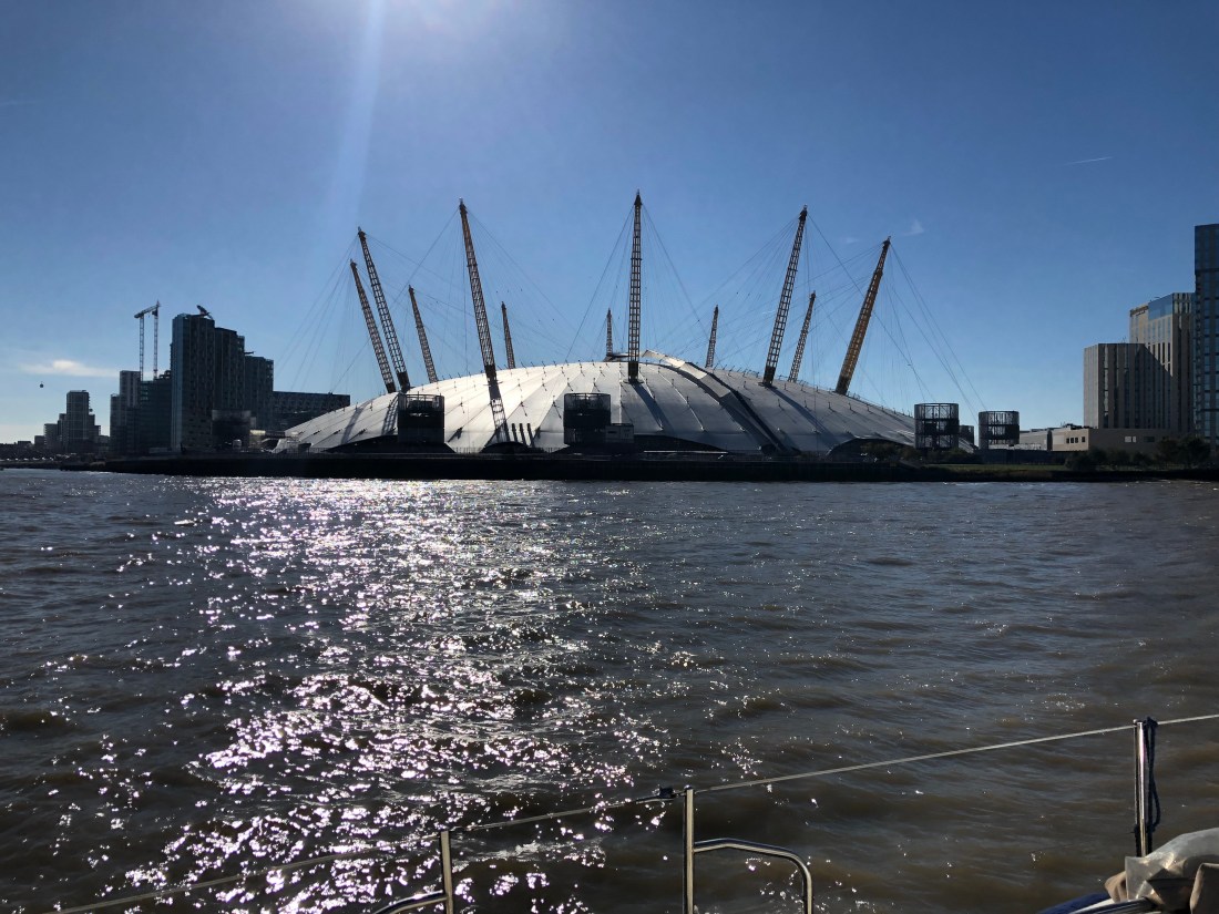
Poli Poli passing the O2 in North Greenwich.
So for the next few hours, we reduced speed to below 5 knots…. very difficult to go slow in a strong flood tide pushing you forwards.
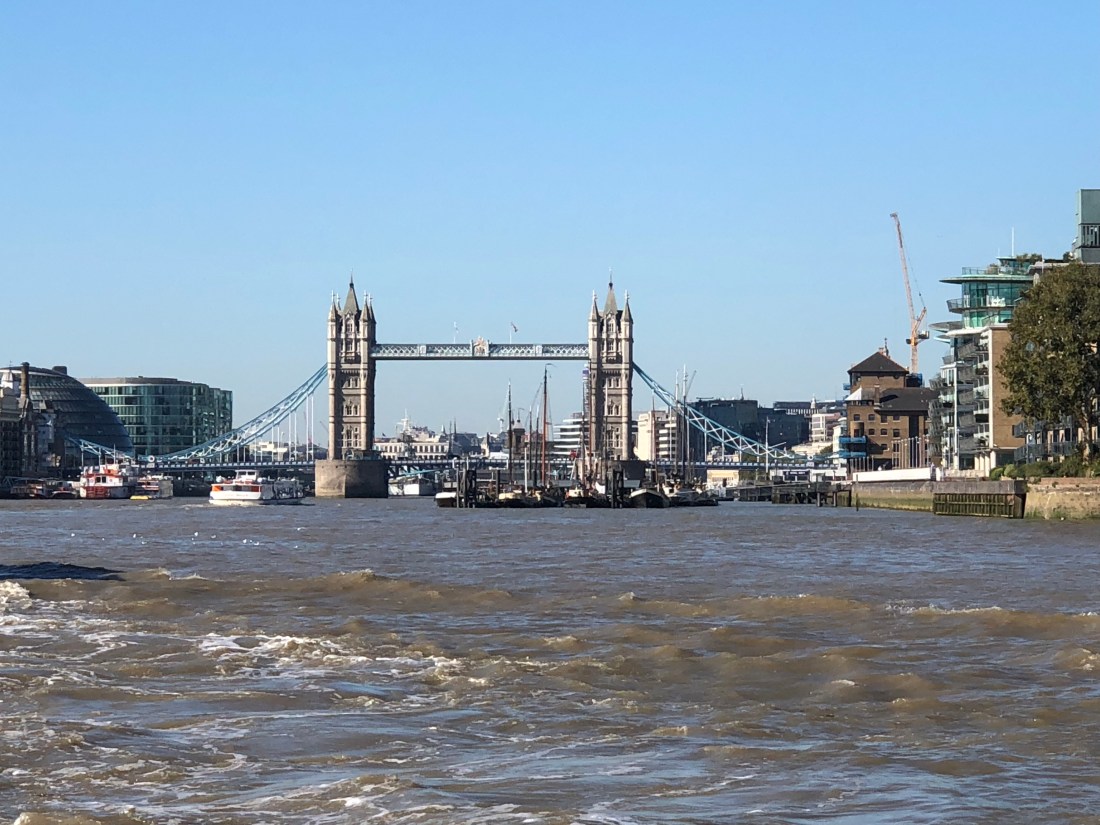
After the Thames Barrier places come up thick and fast. First Greenwich and the Cutty Sark stand resplendent on the south bank…. followed by the high silver glassy landscape of Canary Wharf and the Shard rear up in view. And before you know it you are on the final approach to Tower Bridge…. we arrived at precisely 1.10pm…. 40 n.miles from Queenborough.
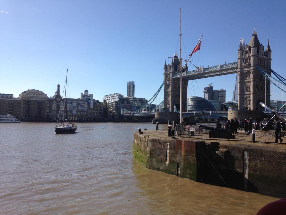
Above …Poli Poli making her final approach to Saint Katherine’s. The lock entrance is on the right just above HMS President.
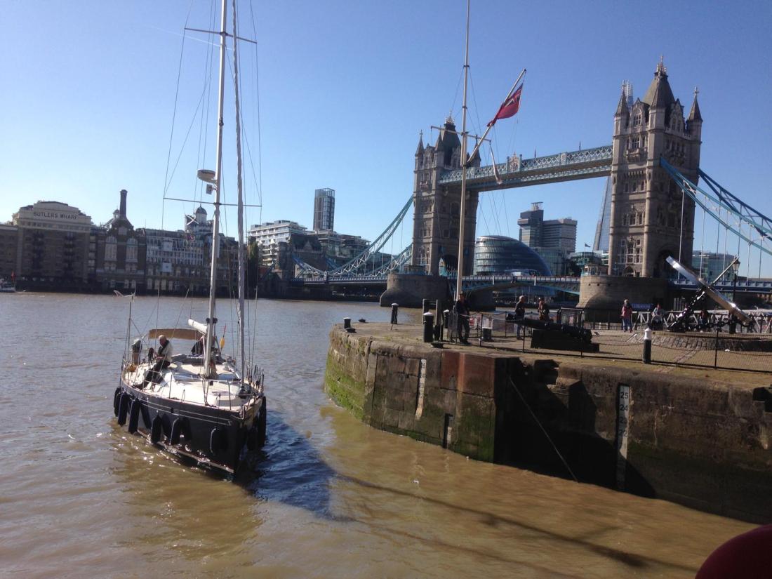
Below…Poli Poli ( now bow into a strong head tide ) approaching the lock ..Margaret took these photos as she had arrived before us.
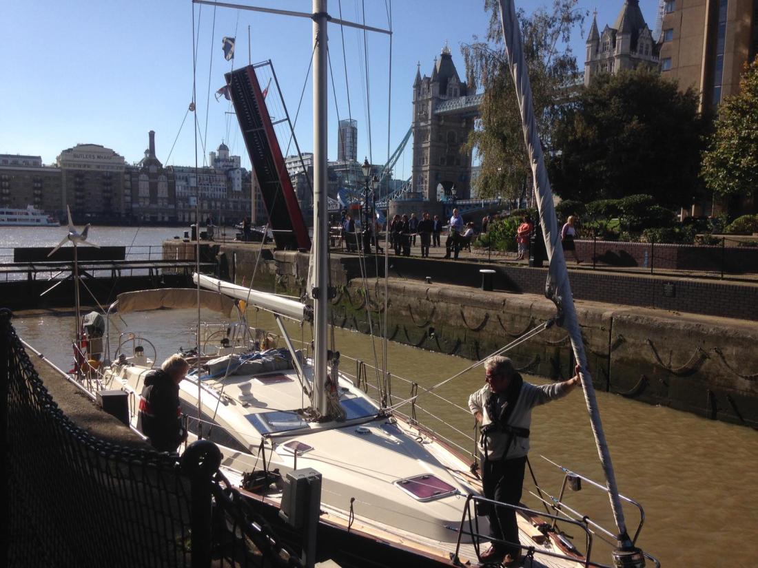
Poli Poli moored safely in the lock at Saint Katharine’s Dock in London ….Tower Bridge in the background.
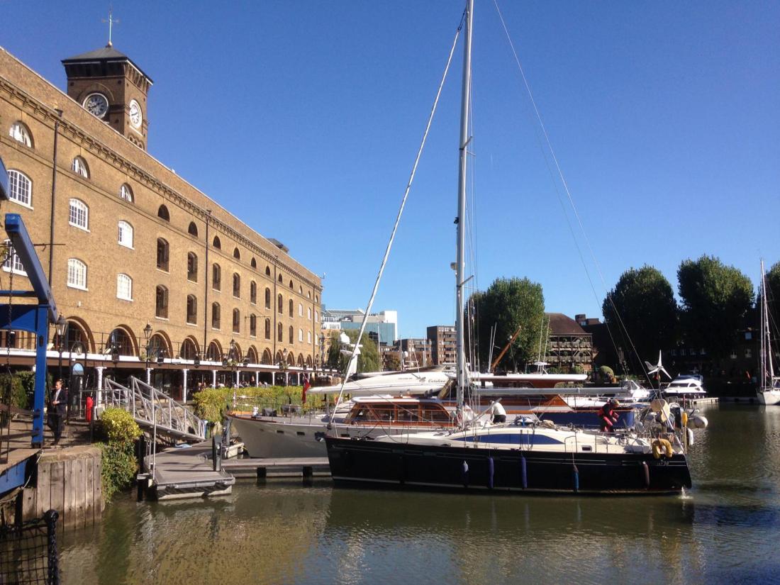
Poli Poli drifting onto her berth in Saint Katherine’s Dock …and a very nice berth now. About 2pm.
Mileage from Queenborough to Saint Katherine’s Dock : 43.70 n. miles.
Total mileage from Eastbourne; 2,610.3 n. miles.
