Day 45, Out of sequence…. Sailing Day Conwy to Liverpool. Tuesday 10th July, 2018.

The day before had been abandoned as there had been a Force 6 strong wind warning from the Met Office. Tuesday, and as always, the day began with weather checking… the force six had been downgraded to “Variable, mainly north or north east Force 3 or 4”.

The problem was no longer the wind…. the problem was now what time we could enter the lock at the marina on the River Mersey in Liverpool.

High Water in Liverpool was scheduled for 21.54 hrs… ie nearly 10pm and we could not get in until the first lock opening which was 7.45pm… so we had to time a sail of some 50 miles very carefully.

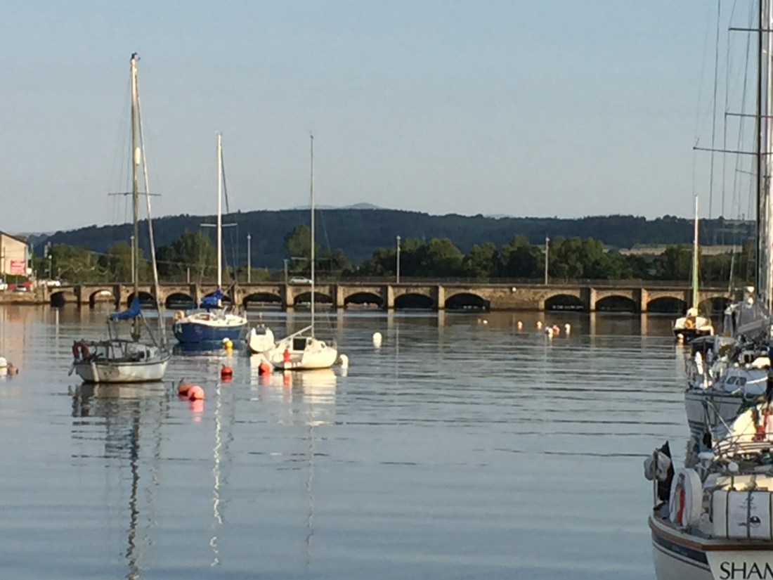
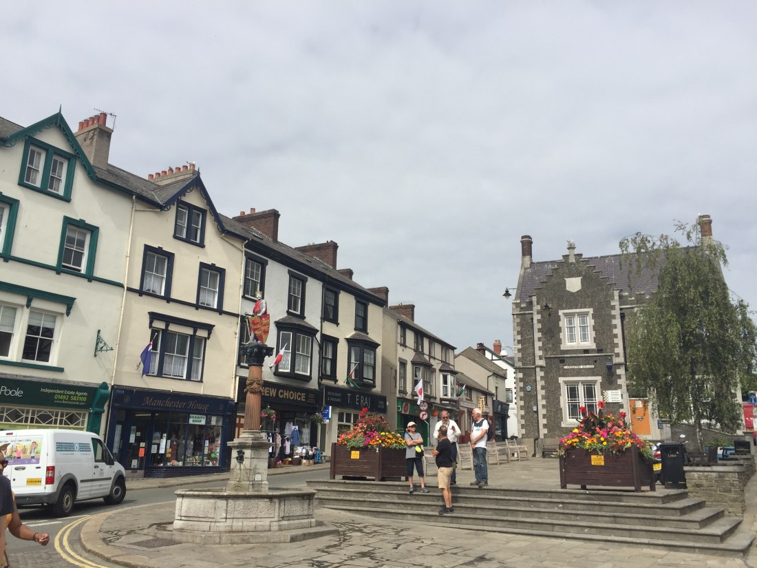
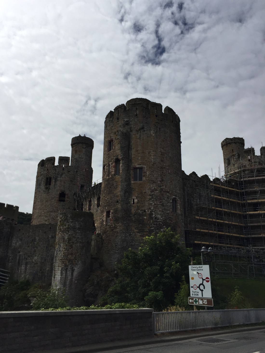
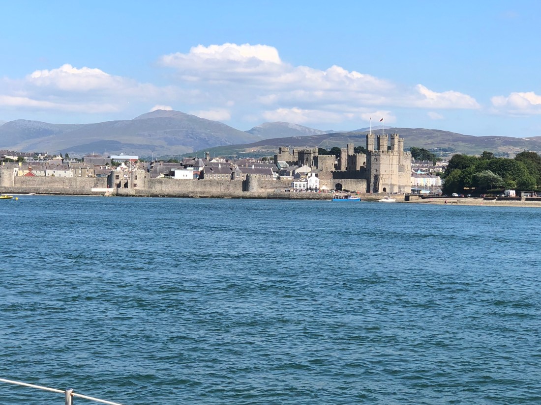
We departed Conwy Marina at 11am ( and a very good, pleasant marina I might add …. apart from a single swan, who when not given food, would attack our fender covers with great force, pecking through the fabric !).

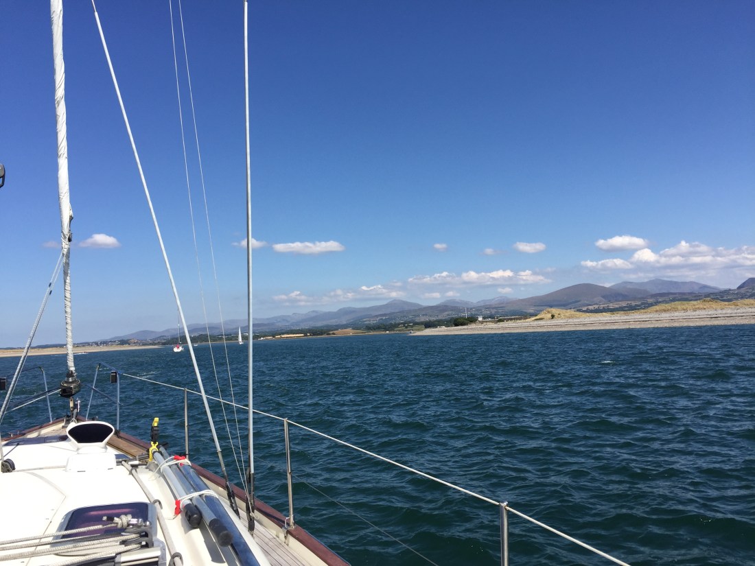
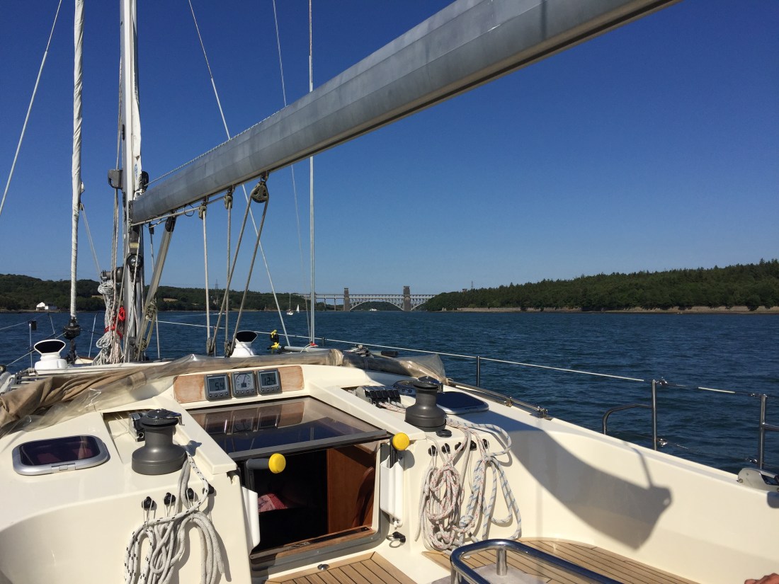
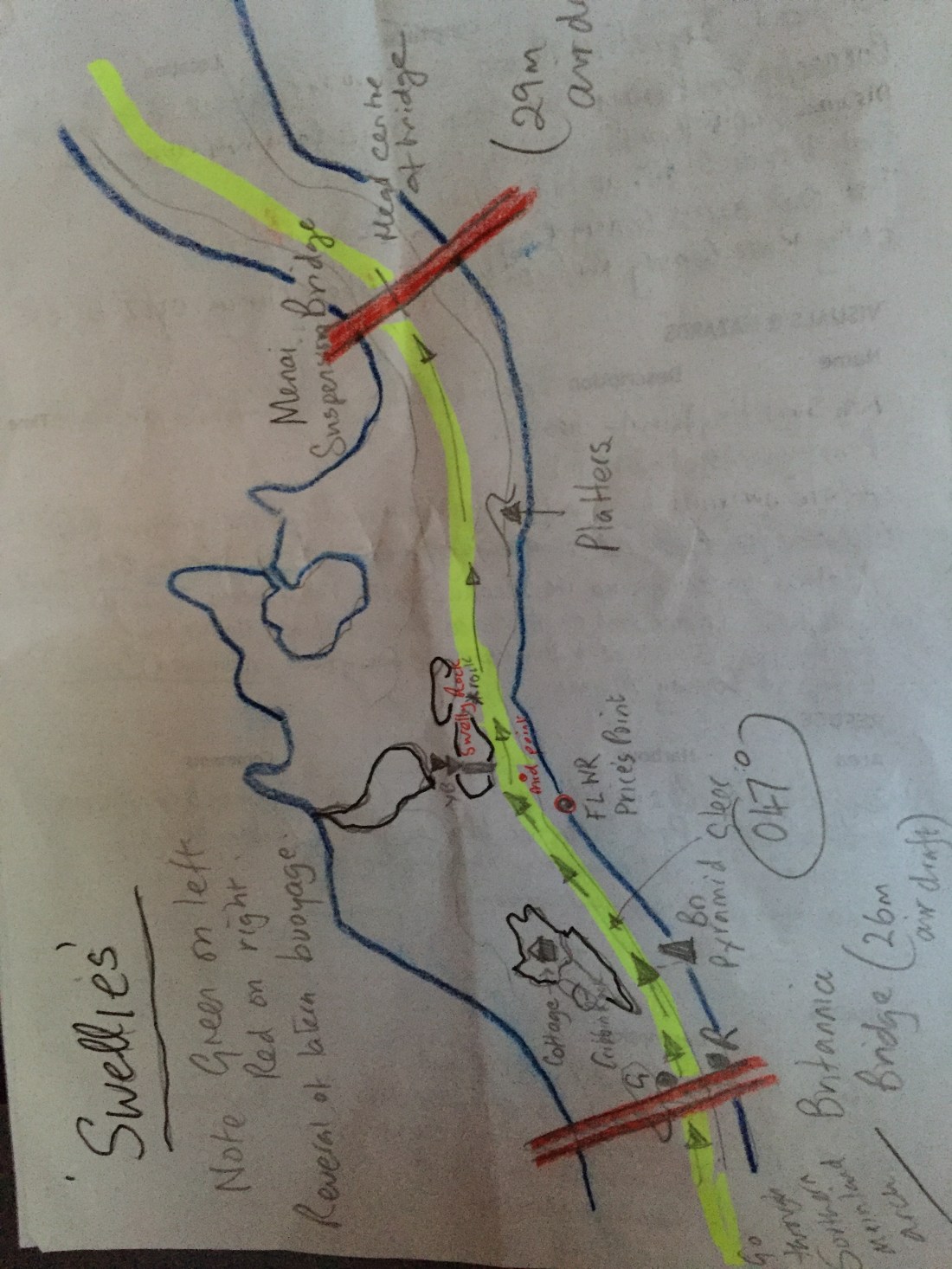
Our initial route took us along the red buoys marking the meandering channel out into Conwy Bay between Great Orme Head to the right, and the Menai Straits and Anglesey to the left. The wind had got up … from the North East and a reasonable 10 to 15 knots…. so up went the sails and Poli Poli at 7 knots moved swiftly out to sea on a close reach.

However, a close or even distant inspection of the sea area known as Liverpool Bay… along the North Wales coast and the Wirral… wow what a congested sailing area this turned out to be. There are large wind farms set out in huge blocks of sea area… great squares or rectangles taken over…. so moving in a straight line was going to be extremely difficult.

Some wind farms were in working order, others were still under construction and to be avoided at all costs…. as both large and small work boats buzzed about from turbine to turbine whilst larger supply vessels ploughed fast routes in the lanes between. Not only wind turbines …. but also gas and oil drilling rigs set up in marked out areas… also to be avoided.

As we had to turn from our northerly sailing tack… to go north east… which now meant we would be head to wind… so no sailing…. and with all our constant changes of course to avoid the congested areas…. down came the sails.

Our aim was to make for what is known as the Q1 buoy…. which marks the start of the Queen’s Channel…. leading you in with all the big commercial shipping into the River Mersey and hence to the heart of the port of Liverpool. Once you reach the Q1 buoy you have to stick very strictly with some 30 plus buoys and ensure that you keep out of the way of the big ships and ferries entering or departing Liverpool.

We finally reached the Q1 buoy at 5.25pm … after some 6 hours of negotiating the oil, gas, and wind turbine fields along the north coast of Wales and the Wirral.  Any vessel…. however large or small is then required to report in via VHF radio,  to VTS…. the Port Authority which manages and regulates the traffic through the Queen’s Channel into Liverpool. It is the same when sailing into the centre of London on the River Thames. The Port of London Authority monitors every single vessel. So we did so and contacted Liverpool VTS on VHF Channel 12.

From the Q1 buoy to Liverpool Marina the distance is 15 n.miles. High Water at the Marina was timed for 10pm… it is now 6pm… so we are in a flood tide which will increase in speed as we get closer to Liverpool. We have to cover the 15 or so miles in about two hours.

As we progressed along the Queen’s Channel sticking to the right hand side… following the green starboard buoys… the wind increased and it became very grey…. gloomy grey. We were passed by various big ships and a huge Stena Line Mersey ferry from Belfast. The latter called us up on the radio and informed us that he would pass us on our port side. The Captain  even got our boat name right. Other vessels calling us up lapsed into the old jokey “Roli Poly” routine…. ha ha we thought. A tanker went by, followed by the 30 knot Isle of Man black and white huge catamaran, a general cargo ship and an ocean going tug….pilot boats whizzed the other way, going out to meet inbound ships and to guide them safely into Liverpool.

Whilst the Queen’s Channel is enormously wide…. greens to the right and reds far over to the left…. when lots of ships are going in opposite directions there have to be very strict rules… ours was simply not to impede commercial shipping. Our progress was monitored as we motored inbound…we overheard radio transmissions between Liverpool VTS and various ships… mentioning our name and requesting care whilst passing “the small sailing yacht Poli Poli who is at position C16” ….. all the bouys are named or numbered as you pass downstream. We felt “looked after”…. thank you Liverpool VTS.

We passed Seaforth ( the new bright red Liverpool docks ), and Bootle on our left, New Brighton and the Wirral on our right… just a bit grey and gloomy… about 7.15pm. We admired the three iconic buildings on our left…. the Liver Building, the Cunard Building and the Port Authority Building with a mini St. Paul’s dome on top!

The tidal stream was now at its fiercest… sailors will know the rule of twelfths… the 123 count up to mid tide and then the 321 to high tide… tidal streams run at their fastest in the two hours either side of mid tide. We were in the second 3…. so the flood was now really sweeping us downstream. Each buoy we passed, sat an an angle with a tidal tail indicating the strength of the Mersey flood tide.

We passed Pier Head ( “Ferry across the Mersey”), Albert Dock, the Echo Arena and the BT Conference Centre…. we were getting close. The marina is but a mile from the Liver Building. In this tide, how do you turn to get across the river to the other side… where the marina entrance and lock is? We were on the right hand side of a very large, swiftly flowing major river.

I spied three motor boats lining up on the far side of the muddy brown Mersey. That gave me a clue as to where the exact entrance was. Secondly, I had noted from homework that you made the turn at a certain cardinal buoy… the Pluckington Bank westerly cardinal.

This we did on full power…. coming head to tide… showing minimum boat profile to the incoming rushing  tide…. and quickly crossed at an angle… almost “ferry gliding” as it is known… until we reached a position immediately behind the three motor boats.

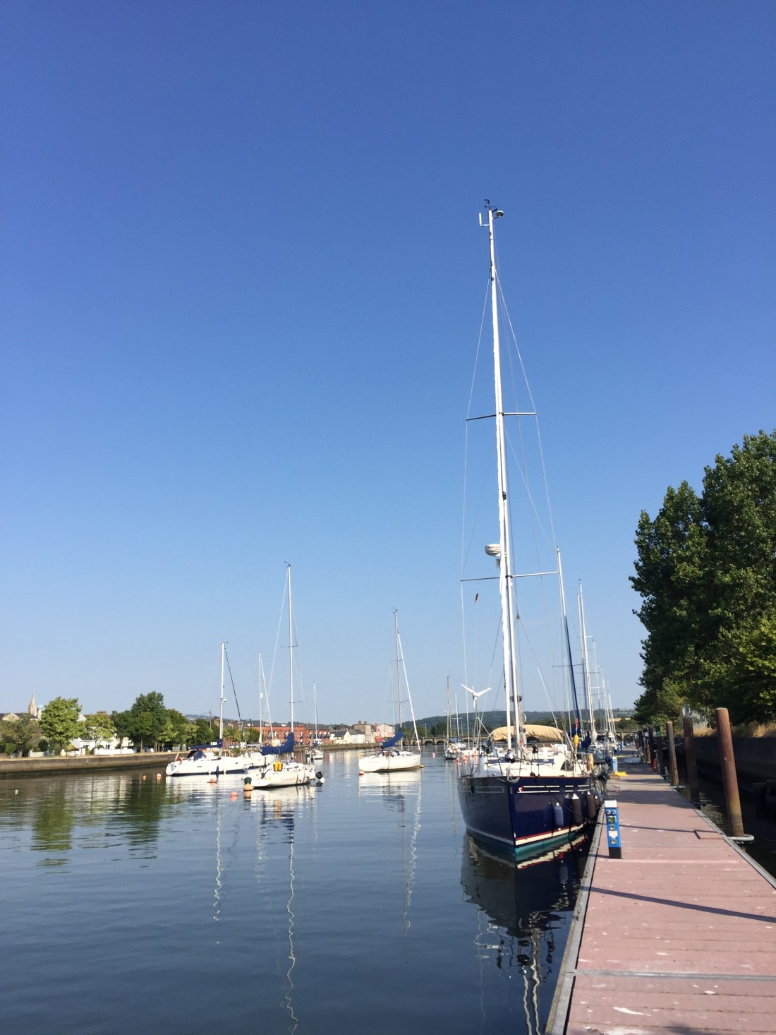
Three green lights came on, our keel came up, and with some considerable relief we entered the lock…. and rafted up against a fishing boat to one side full of amiable, friendly and very helpful Liverpudlians. One even offered me a fresh mackerel from his day’s catch. Many Liverpool/Everton type jokes…. and the fishing boat then led us to a lovely side on berth close to the facilities.

IMG_6109.JPG

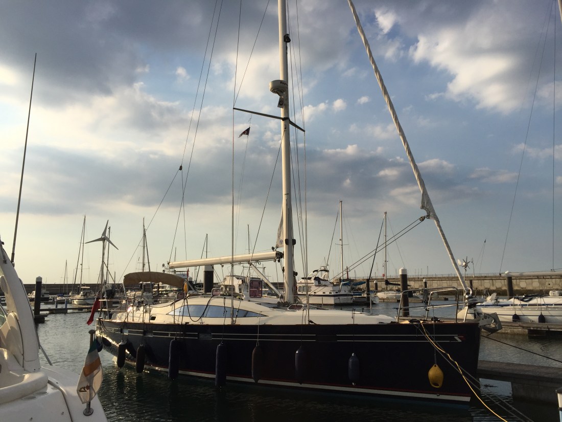
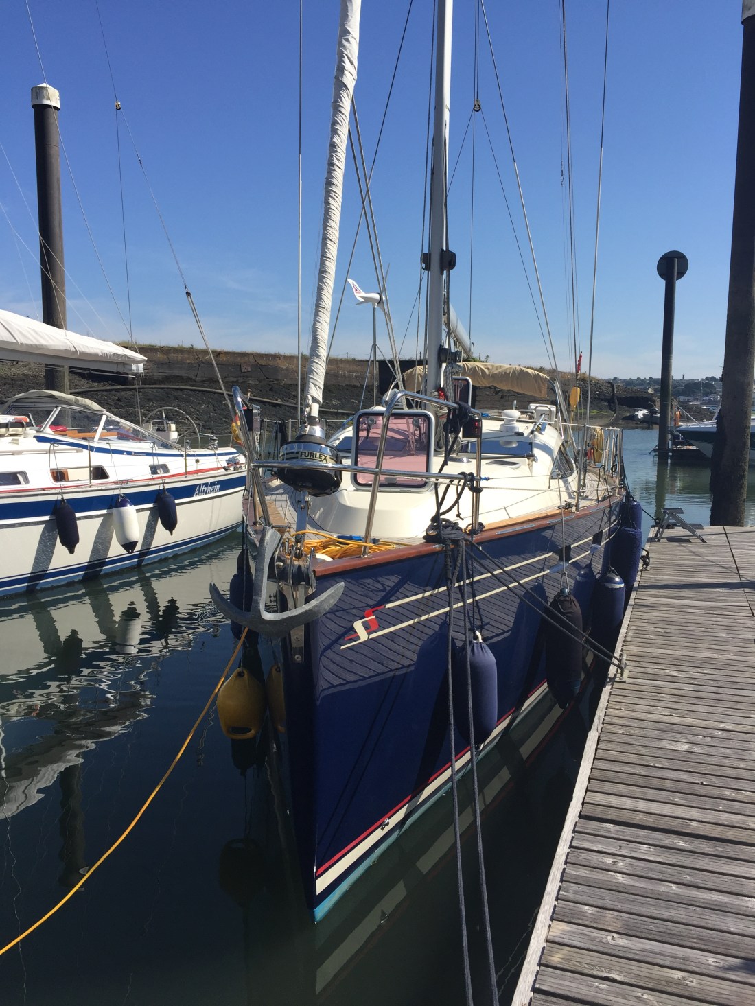
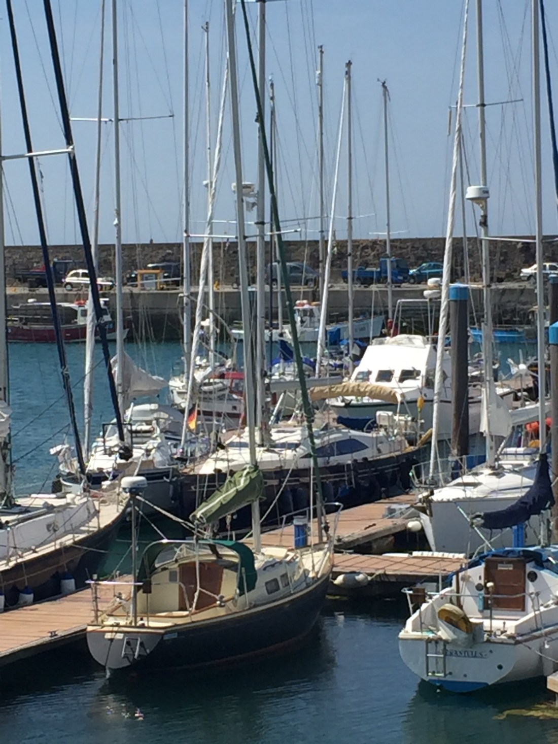
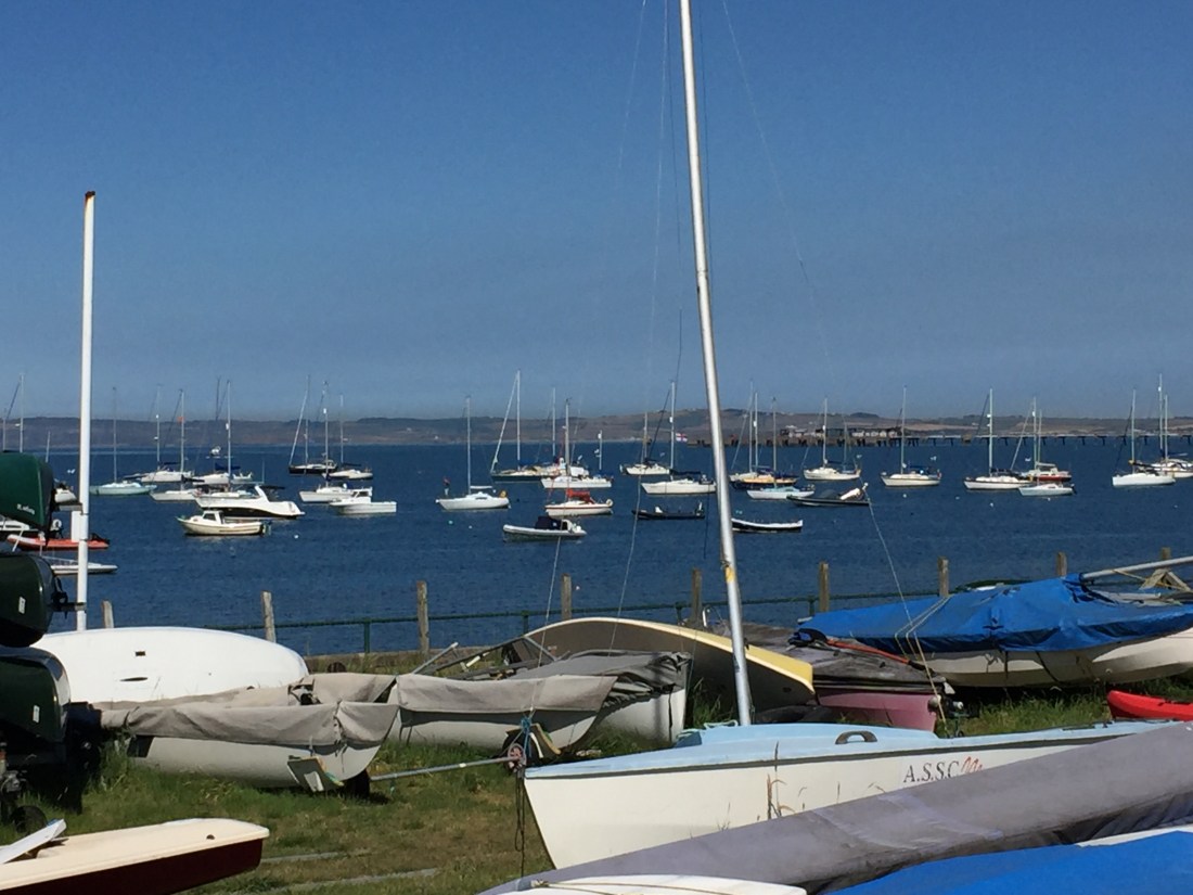
A very crowded Liverpool Marina…. you can spy Poli Poli centre left with dark blue hull on outside long berth.

At 8.15pm we were safely moored up. We raced to  the Yacht Club  only to find that they stopped serving food at 8pm! So a pint and two bags of crisps each was our ration. Later back on the boat, Mike served up gourmet style beans on toast. We were fast asleep in our cabins by 11pm. Dreaming of windfarms and big, big ships!

Total distance: Conwy to Liverpool 55.6 n.miles.

Distance from Eastbourne: 1,076.7 n.miles.

IMG_6111.JPG

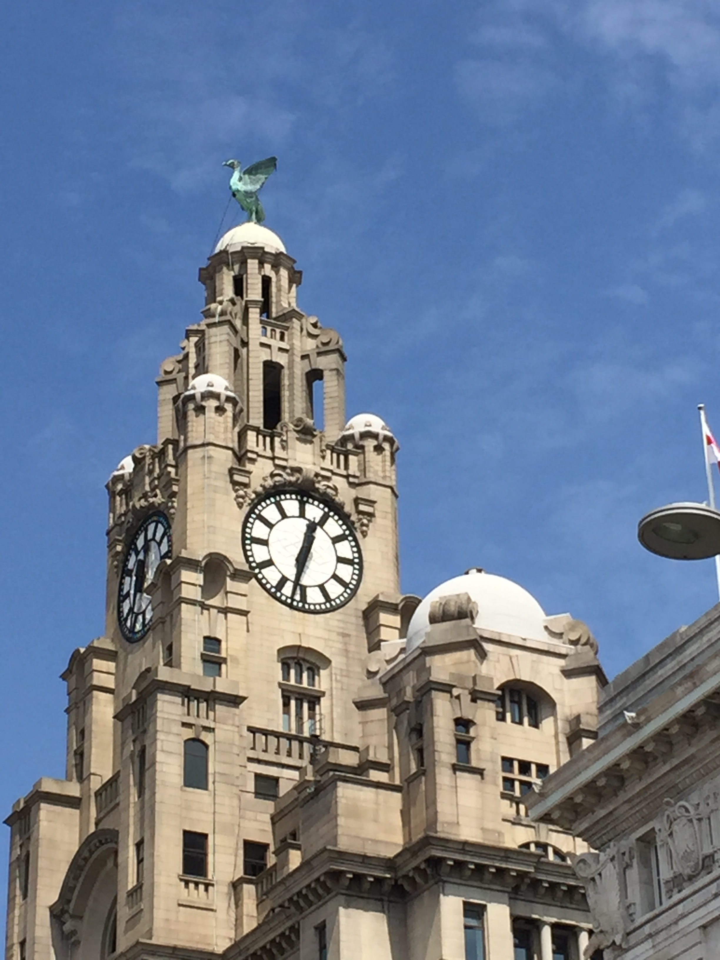
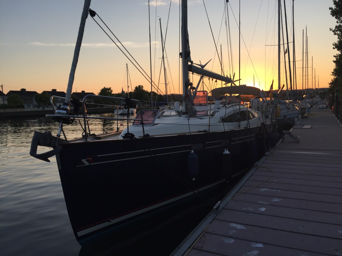
The Liver Building taken on the next day in Liverpool…. our rest day, Wednesday 11th July, 2018.


Days 40 and 41, Rest days in Dun Laoghaire ( Dublin )… Friday 6th July and Saturday 7th July 2018. ( Out of sequence )!

Both days were warm, airless apart from the evenings when the sea breezes kicked in…. sunshine and blue sky. There were problems with internet connections on both days as the marina provision did not seem to work and when it did it was intermittent.

On the Friday morning Mike hired a car and drove westwards towards the River Shannon where he met up with family and did family business. T on the other hand remained on the boat and its immediate vicinity and did five loads of laundry…. and very expensive that was. Each wash was 5 euros and each 30 minute drying session was 3 Euros x 4 = 40 Euros in total.

IMG_6022

Photo of my foot…. the left hand side of the laundry room at Dun Laoghaire ( Dublin )…. please note Simon in Bexleyheath how many small digital pads there are to press!

Each wash gobbled up Euro coins, so there were at least 3 visits to the Marina Office to get change. Please appreciate how far the boat was from the actual laundry… T did over 11,000 steps on this day, nearly 5 miles back and forth!! For Bridget… two “colours”, two “whites” and one bed laundry. And for Simon in Bexleyheath…. each marina provides different washing machines and different dryers… so I am an expert now in the art of knowing how to do the washing! Although, I was before coming on this trip! My fourth major ” laundry day” of the trip…. the others being Portland, Falmouth and Bristol.

I also made excursions into Dun Laoghaire to the supermarket…. and very soon it was becoming more and more apparent that Ireland and the Euro was an expensive place. Victuals were purchased to fill the fridge and dry goods cupboard. Mike returned in the evening and we had a late supper at Nando’s… sitting outside. Excellent food quality, but poor service and a most peculiar tasting fizzy beer made in Mozambique. According to various reports in the press… Nando’s is opening more and more restaurants because they have captured the niche market in making chicken “taste different” whilst other chains, like Prezzo, Zizzi, Jamie Oliver… are closing restaurants up and down the country…because they  do not have a unique, brand “flavour”…. who knows? But I did think the beer really strange.

Friday 6th July… 2018, Rest Day Two. Dun Laoghaire ( Dublin ).

Again a warm sunny day. Mike decided to do his laundry today and return the hire car. Following this we caught the train into the centre of Dublin. If you recall, the last time we had done this…. was in Cardiff. Really old fashioned, noisy diesel trains there. In Ireland they were reasonably posh, quiet overhead electric ones. The return ticket cost 6.25 Euros each which considering it was not purchased  with a Senior Rail Card discount…. started to dispel some of my ideas about Ireland being expensive. So train travel in Eire appears reasonable… this was for a journey of well over half an hour and six stops.

We passed through the outer Dublin suburbs, skirting the very wide Dublin Bay… which at low tide looked somewhere between mud and sand with small streams running here there and everywhere. So we passed through stations called Sandymount, Blackrock, Lansdowne Road ( big international football stadium there ), Grand Canal Dock ( full of houseboats ) and we got off at Pearse Station very close to Trinity College.

My sister had intimated strongly that we should go and see the “Book of Kells”…. and what my sister says goes… so go we did… to Trinity College. It was hot and muggy…walking in and out of thousands of tourists getting off coaches outside Trinity College was not easy… but we made it to the main entrance in College Green/College Street and promptly joined a tourist queue to buy a ticket for a walking tour which included the Book of Kells. 14 Euros each.

For the next couple of hours we were in the company of a student led tourist group of about 20 people…. which set off at 11.45am in the main Trinity College courtyard. Our leader was a very confident, articulate and well rehearsed second year undergraduate studying “European Studies”…. she was very good indeed… and dressed in the dark brown undergrad gown.

IMG_6034.JPG

Photo…. our guide a second year undergraduate at Trinity College. For the best part of 45 minutes this young lady captured and held her audience with a mixture of humour, precise historical detail and fabled university anecdotes handed down over generations.

IMG_6039.JPG

Sadly, in one of the principle courtyards of Trinity…. all the trees were being chopped down!! Some dreadful disease had caused serious distress and when the word got out… students do what they do… they demonstrated!

IMG_6036.JPG

Tree surgeons at work in Trinity College. Centre right…. the left over stump!

Following our guided tour, our brilliant and lovely guide, took her leave as we went off to the main Library …. one of the world’s great research libraries, holding the largest collection of manuscripts and printed books in Ireland. Our esteemed guide claimed the length of all the books placed side by side would exceed the Cambridge length by at least a yard or metre in new money. Cambridge University Library also claims to be the largest ( the big black tower you always see from the M11 whilst driving north up from Duxford and probably wondered what it was ). T spent many a happy hour in that tower writing a thesis ). I had the good manners not to challenge the young lady.

So we finally arrived at the Book of Kells. We queued for a little while outside what is referred to as the Old Library at Trinity before being ushered into the section known as the Treasury. Here we viewed a magnificent exhibition leading us by way of history and explanation in a smaller room holding the Book of Kells…. plus the Book of Armagh and the Book of Durrow in the East Pavilion.

The Book of Kells is over a thousand years old… and contains lavishly decorated copy, in Latin, of the four Gospels. The book was probably produced early in the 9th century by the monks of Iona…. to the west of Scotland.

In a darkened room, hundreds of folk, squeezed, craned, some shoving… to peer over at the four manuscripts in a dimly lit glass central cabinet. As one person finished and moved, ten tried to squeeze into the available space. Lots of “ooohs” and “aahs”…. but we did manage to observe the Book of Kells.

We completed our tour of Trinity with a visit to the Long Room of the Library which houses some 200,000 of the Library’s oldest books. The books on shelves… go all the way up to the roof… and in fact on one occasion in the past… the roof had to be raised and re-built. What a lot of dusting!!!!! Also interesting were the marble sculptured busts of great cultural and academic worthies down through the ages…. as well as the oldest surviving harp in Ireland which probably dates from the fifteenth century.

By 2pm we were exhausted.

A pleasant late lunch was taken in a restaurant on the banks of the Liffey River which runs through central Dublin …. next to the O’Connell Bridge ( and that is even more history!).

So we caught the swift, overhead electric train from Tara Street Station back to Dun Laoghaire. Heads full of history one might say… but only a snippet of Dublin in the time available.

IMG_6043

Dublin of course is not just about the Book of Kells and Trinity College. We spied the statute of Molly Malone …. cockles and mussels fame…. but did not see Phoenix Park, Dublin Castle, Croke Park, the Spire, or anything connected with Oscar Wilde, James Joyce, Sean O’Casey, or the Famine Memorial…. time was not on our side…. but we got a flavour of the city.


Day 44, Monday 9th July 2018…. strong wind warning, red line so a no sailing day… walk round Conwy, North Wales.

We had not experienced a “weather bound” day since Newlyn in the very south west of Cornwall. It was therefore, to our surprise when the 0600 hrs Met Office Inshore Waters forecast placed a red line round the coast from Great Ormes Head to the Mull of Galloway with force 6 winds.

Whether or not we sail is governed by the “red line” principle…. a force 6 and above is a signal for both difficult and dangerous sailing conditions,  so in 99 per cent of red line cases…. we don’t go. If though, in a 24 hour forecast the words ‘force 6 later” appear and we are actually sailing early in the 24 hour forecast… then we might well depart…. as long as can sail to our destination well before the “later” 6 occurs.

Now, over the the past 20 or so years, there has been a massive proliferation in weather forecasting web sites and in the development of weather apps. And in many cases they give different forecasts of wind conditions to the Met Office. So on this particular day, Wind Ghuru and XC Weather apps did not forecast force 6. This raises all sorts of serious questions for a sailor…. do you simply go round all the weather sites and apps until you find one which suits you? Then sail?

By and large, my faith is in the Met Office…. but I will also just check out one or two other forecasts to see if there is any correlation… then I look outside, I look at the synoptic pressure charts, and if they are available… I go to current observations out at sea from weather buoys where the recordings can tell you what the condtions are at a specific time… and then you can work out the possible projections of what might happen later with wind speeds…. eg pressure falling, wind speeds increasing over time etc. But I do not go and search for a weather forecast that “I like”.

So Mike and I spent a few hours walking into the very pleasant little town of Conwy, with its large fortified walls and gateways, plus a magnificent castle dominating the skyline. Breakfast was taken at No.2 The Square…. a lovely cafe where both quality and service were outstanding. We browsed the shops and as time went on, tourists began to appear in ever larger numbers. Mike bought a book on “Tides” and I bought postcards for various folk.

4509E52D-9D8E-40F5-BB7F-D39E95022AFE

The photo above is the main square in Conwy..the full Welsh Breakfast on the left.

We did spend some time on the Conwy harbour frontage, observing a “grounding”. At this time the tide was flowing out…. the ebb…. quite rapidly. What looked like a classic small yacht with a long bowsprit had run aground close inshore.

AA583EB0-7782-4E16-BE95-D807085D0DB8

Two of the guys ended up jumping off into the muddy shallows, waist deep and trying to push her off… to no avail. Methinks they would be there for a few hours! Hope they had towels and a change of clothes.

47ABBEBD-4D48-4F37-9A0F-D4DF34D82550

T on the Conwy harbour front…. ebb tide.

Out of habit now, if we pass an RNLBI shop or boat station, we nearly always go in and buy some item or items to support the organisation. I looked around, chatted to the lady and pointed out the vessel outside well and truly stuck in the mud. She indicated that they would keep “a watching brief” over the boatl! As I did not need anymore RNLBI mugs or tea towels… I thought, why not…. buy a packet of RNLBI christmas cards …so as to give Margaret a head start.

So I said to the very nice lady…. “oooohh I must be the very first!” To my horror she said not. The Xmas cards had been delivered late… many locals had been asking ( in June for goodness sake! )…. and now her stock had nearly sold out. Mine was the last of three packets! This was early July…. what is the matter with people??

9F2EA2C6-4E73-400F-AB3C-10E86F5C0D85
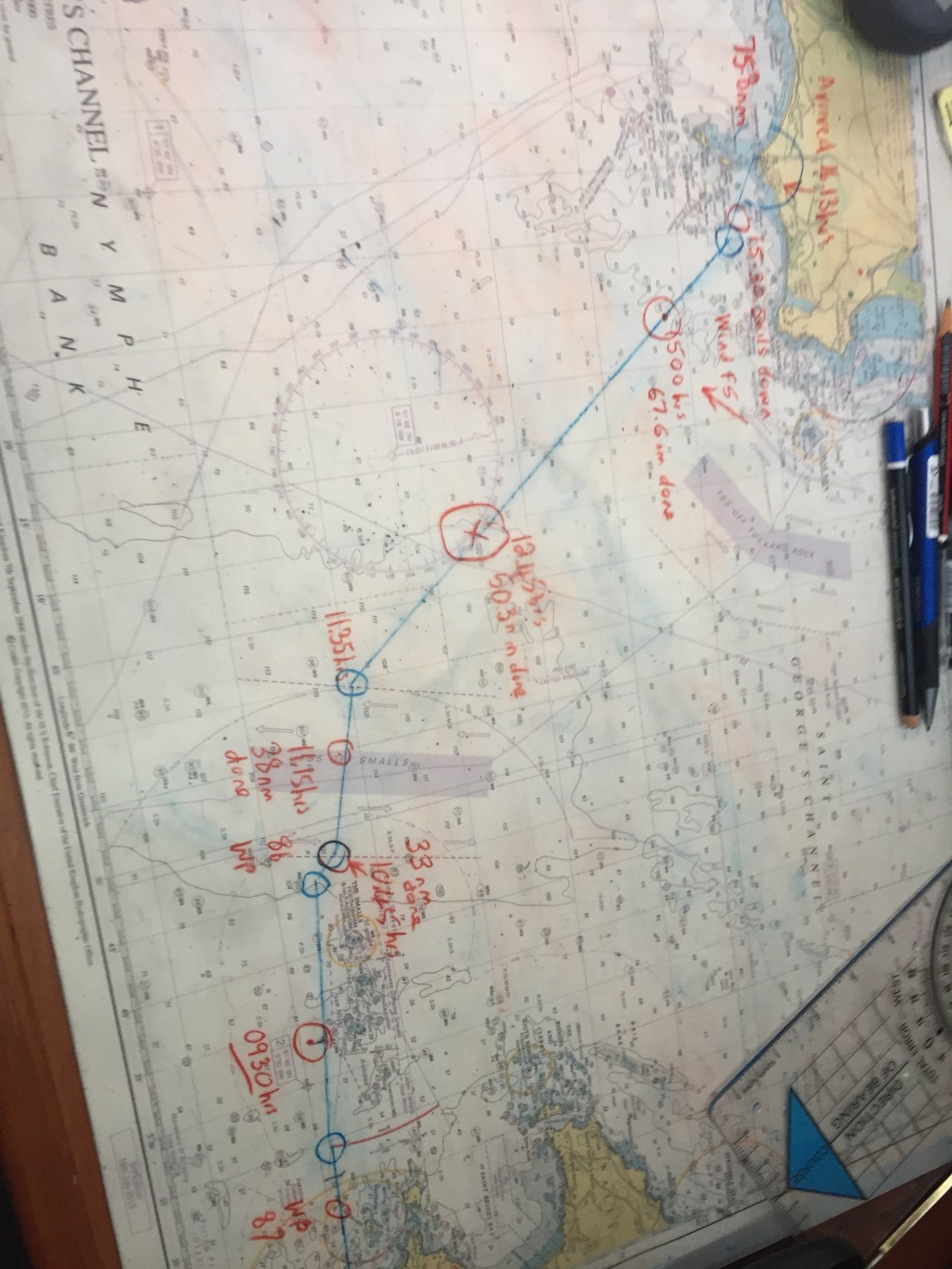
Back to the boat pm…. a big, big wash down and scrub for Poli Poli… she was shampooed but not waxed… got all the horrible salt off the gelcoat hull, the coach roof… and the crumbs from the cockpit floor. Then, after checking the 6pm forecast, and noticing that the red line had come off…. got out the relevant chart, wrote a passage plan and prepared the log book for the morrow. We planned to depart at 11am from Conwy and sail the 50 or so miles to the great port of Liverpool on the River Mersey.

C1C479A3-56A5-40B8-A19D-6F9EF6B11CBF

Photo above..Conwy claims to have the smallest house in Great Britain.

In terms of the third revised schedule, I have decided to cancel the leg planned from the Isle of Man to Whitehaven and then the leg from Whitehaven to Bangor ( Belfast ).

I was only going to Whitehaven to meet a retired colleague who I had worked alongside as a Deputy in a Northamptonshire school. He recently informed me that he had sold his house in Cumbria and had moved to Ampleforth in North Yorkshire… ie the other side of the country. We will probably meet up when Poli Poli sails down the north east coast of England in late September, early October. So the “weather bound” day in Conwy has not cost us anything in terms of a delay to the third revised schedule.

980CEF22-D33B-41B6-BAE1-DD6A88119867

Day 43… Sunday 8th July… the day the “Swellies” were conquered by Poli Poli ( not such a big deal after all !! )… Holyhead to Conwy in North Wales.

Holyhead Sailing Club…. where we stayed hooked up to a big orange mooring buoy courtesy of the Holyhead Sailing Club for £20 a night and a free water taxi… plus use of the clubhouse, bar, giant TV screen ( England v Sweden second half ), toilets and showers…. were wonderful. We cannot speak highly enough of their welcome and  facilities. Marvellous.

IMG_6065.JPG

Photo above…. the mooring buoy at Holyhead provided by the Holyhead Sailing Club…. at £20 per night for Poli Poli. The blue fender in a horizontal position stops the green rope from chafing on the Oxford Blue gel coat!

IMG_6067

The Holyhead Sailing club building is immediately behind the centre sailing yacht’s fore stay ( furled jib sail ) on the bow. The Met Office describe the sea surface above as “smooth”!

The day’s sail was effectively planned around three serious tidal pinch points.

Firstly, we had to reach the Caenarfon Bar… a major sandbank… no later than 3pm to get across and into the Menai Straits from the southern end.

Secondly we had to reach the Britannia Bridge in the Menai Straits no later than 5pm…. and then in order to access Conwy  Marina tidal sill… arrive no earlier than 6pm. So a lot of pre- planning took place before our scheduled departure from Holyhead at 12 noon.

Leave too early and there would not be enough water over the Caenarfon Bar…. and we would have to do big circles out at sea wasting fuel ……so the  timing had to be right.

It was 22 n.miles from our mooring buoy on the northern end of Holy Island… which sort of buts onto the island of Anglesey….. to the Fairway Buoy at the sandbank Caenarfon Bar. Once out and round the long, long breakwater wall and into the Irish Sea… what do we find…. a flat, glassy, oily looking sea surface and nil wind. So motoring …. which has been the theme of our passages since the heatwave first arrived over Great Britain.

IMG_6068

Poli Poli crossing the Caenarfon Bar at about 3pm… the entrance of the Menai Straits  are ahead… we are following the two sailing yachts ahead of us. To the right of the photo are the mountains of Snowdonia.

We arrived at the Bar at 3pm…. but we had to slow down earlier in order to do so. Mike helmed  Poli Poli into the Menai Straits and past the very historic looking town and port of Caenarfon. As we motored past we observed one of the largest and most imposing fortifications built by the English in Wales…. namely Caenarfon Castle. The town is a Royal town granted that status by Queen Elizabeth in 1963. Caenarfon of course, is also remembered for the investiture ceremony for Charles, Prince of Wales.

93F718DC-251D-4B93-B70C-FC905196668B

The town of Caernarfon on the Menai Straits seen from Poli Poli motoring North eastwards.


Two early interesting points about the Menai Straits….. one the speed limit of 5 knots…. totally abused by very fast “tripper” ribs roaring up and down accompanied by big flashy motor boats doing well over 20 knots!!

Secondly…. something I have not seen before… but once past a certain cardinal buoy in Caenarfon …. the lateral buoyage system was reversed  ie the reds and greens. Normally, if you enter any channel that is buoyed…. greens will always be on the right and reds always on your left! Except that is in the good old USA and parts of North America… it is reversed. Typical.

Anyway just past Caenarfon the reds appear on the right and the greens on the left. Maybe something to do with Caenarfon being a port and small coasters coming into the Menai Straits from the north east side of Anglesey? Never seen this before.

The scenery either side of the Menai straits is very impressive. We passed such small settlements as Port Dinorwic…. a small town on the mainland side of the Straits on a huge arc of a bend. Very impressive from the cockpit of Poli Poli as we passed by at 5 knots. The mainland side of the Menai Straits are set against the magnificent backdrop of the Welsh Mountains….. as we came south from Holy Island we could make out the peaks of the Snowdonia National Park range….  namely the two highest summits of Glyder Fawr at 999m high and just jutting into the base of white fluffy clouds to the south west, Snowdon or Yr Wyddfa at 1,085m high. A magnificent sight in the perfect visibility of a blue sky with only fair weather clouds occasionally butting in.

We reached Port Dinorwic at about 4.30pm….. a bit too early… so we slowed down to 4 knots and took stock, thus allowing a smaller white sailing yacht ( motoring ) to overtake us…. as well as a couple of “tripper” orange ribs which went thundering past. We needed to be at the Britannia Bridge just after 5pm. Why?

The section of the Menai Straits …. between the Britannia Bridge and the newer Menai suspension Bridge are known as the “Swellies” and this short part of the Menai Straits has a quite fearsome reputation…. if you get your timing wrong. The Swellies is a stretch of water which is widely known for its difficulty in safely navigating its shallows, shoals and huge underwater rocks…. due to whirlpools and surges. These are the result of the big tides washing around the island of Anglesey at different speeds.

IMG_6072

Poli Poli “pausing” before the Britannia Bridge, in the Menai Straits…. just before 5pm… waiting for “slack high water” to occur.

The “Swellies” was the site of the loss of the naval training ship HMS Conway in 1953 and other maritime disasters which have resulted in a loss of life over the passage of time. Most of the sailors standard reference works such as the almanacs Reeds and the Cruising Association plus the various pilot books…. paint a very difficult and hazardous picture of passage making through the Swellies. If you read the advice, if you then mull it over…. you would never do it… one pilot book mentions…. getting the timing wrong… “it is as if someone has pulled a switch”…. that you will be faced with an incoming tide of great force.


So we planned and worked out the best time to go through the Swellies. The advice is to approach the Britannia Bridge at slack high water. You then have to work out when this occurs… by reference to high tide times at Dover and Liverpool. So Swellies slack high water occurs at HW Liverpool minus 2 hours and minus 2 and a half hours at HW Dover. This calculation gave us 5pm to 5.50pm…. with others saying “better to be early than late”…. very difficult to abort once you are between the two bridges.

With some apprehension, Poli Poli was steered through the centre of the mainland arch of the Britannia Bridge. Mike looked up in trepidation…. not worried about what menacing forces lay the other side …. more worried about our air draft and the top of the mast clearing the bridge. It was near high water so it was an issue. The charts stated that the air draft of the Britannia Bridge was 27.4 metres, the air draft of Poli Poli is 20 metres but not accounting for the wind-x and VHF whip aerial which extend for possibly another metre and a half. It looked close as we both looked up!!

BE6EBF9B-7F02-4BD1-B9D8-DBFD7256FE6F

We crossed into the Swellies at 4 knots speed, following to the letter the various navigational instructions we had so diligently absorbed from almanacs and pilots… “stay to the right”, “keep over”, “find the passage between the white cottage and the cardinal mark  on Swelly Rock “…. “steer 047 deg between the pyramid after passing under the bridge to a mid point between Price’s Point and the Swelly Rock”… and so forth.


I had committed this to a sketch diagram on a piece of A4 paper…. which, as I was concentrating on the visual ahead, I did not have time to refer to. It was stuffed in my back pocket!The black and yellow cardinal mark was very evident…. so to the right we kept our course and headed for Swelly rock. Being near high water, the vast majority of the big black rocks were covered …. except Gribben Rock on which is the very conspicuous white cottage and Swelly Rock in the distance.

BCB57EAD-BCBA-4EBE-A172-C703F7C5BC7B

This is what the Swellies look like at low tide. Please turn pic on side.


What I did notice though… that even though it was slack water…. dark blue if not black and menacing…. the surface in many areas was in circular motion….these were the whirlpools and tidal eddies. Our passage took us passed these.

A4A19E43-0E69-4803-B9D7-60AF6BD1D0E3

My annotated sketch map of the Swellies..again please turn on side!


With some relief we exited the section between Price’s Point and Swelly Island and headed for the sanctuary of the middle part of the huge Menai suspension bridge…. passing the infamous rocks ( now covered ) known as The Platters. The entire passage took no more than 20 minutes!!  Job done…. objective achieved. Tick off the “Swellies”…. along with the Alderney Race, the Portland Bill inner passage, the Swinge on the west side of Alderney…. and one or to others.

Mike helmed north eastwards past Bangor on the mainland side, and the very pretty town of Beaumaris on Anglesey, a rusty old pier thrusting out from Bangor…. all the way to Puffin Island ( we looked but saw no puffins )…. then across Conwy Bay to the fairway plastic buoy marking the approaches to the River Conwy.

After a significant number of red and green buoys ( on the normal side now )… following a meandering channel into the town of Conwy, we moored up safely at the marina…. having crossed a very specialised tidal sill… one I had not encountered before… on a traffic light system… at 7.30pm. We noted that the Mullberry Pub overlooking the marina… was thronged with folk… Sunday evening in the fading sun. A long day…a near eight hour passage…. crossing the Caenarfon Bar and transit through the Swellies.

Holyhead to Conwy via Caenarfon and the Swellies… 51.5 n.miles.

1,021.1 n.miles from Eastbourne. 2,000 n.miles to go!


Days 40, 41, and 42…5th, 6th and 7th July 2018. Dublin back to Wales in 8 hours.

533A7A99-FAA1-4874-80AA-6054D046B6D4
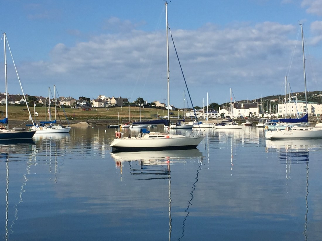
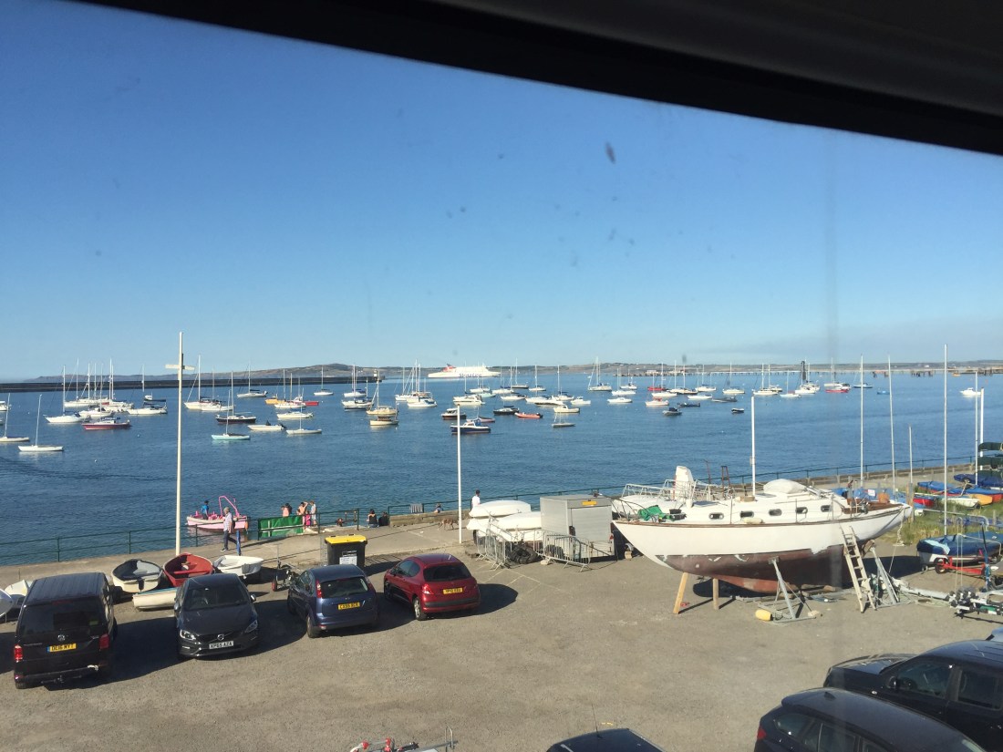
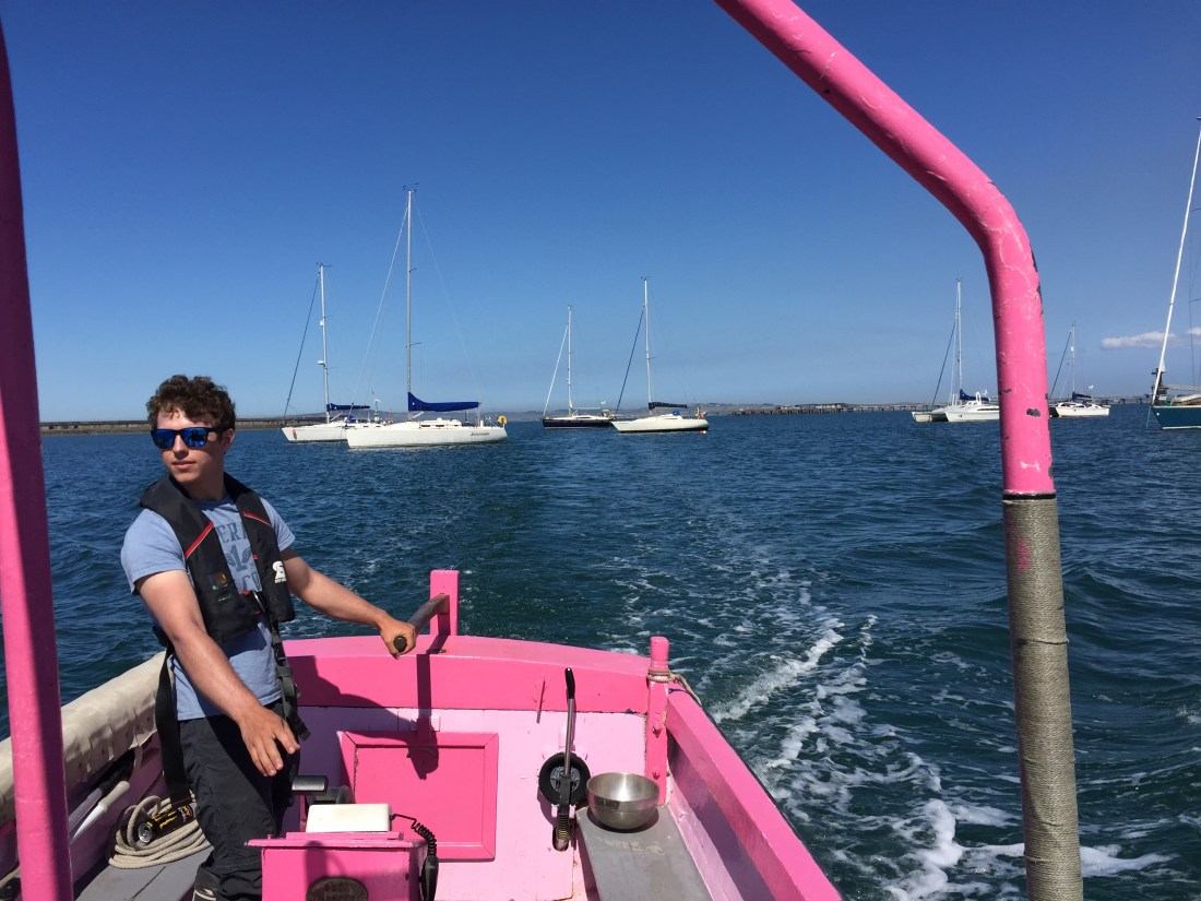
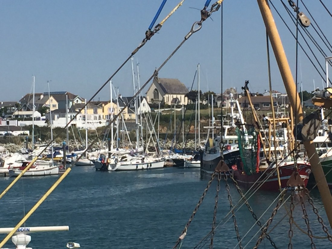
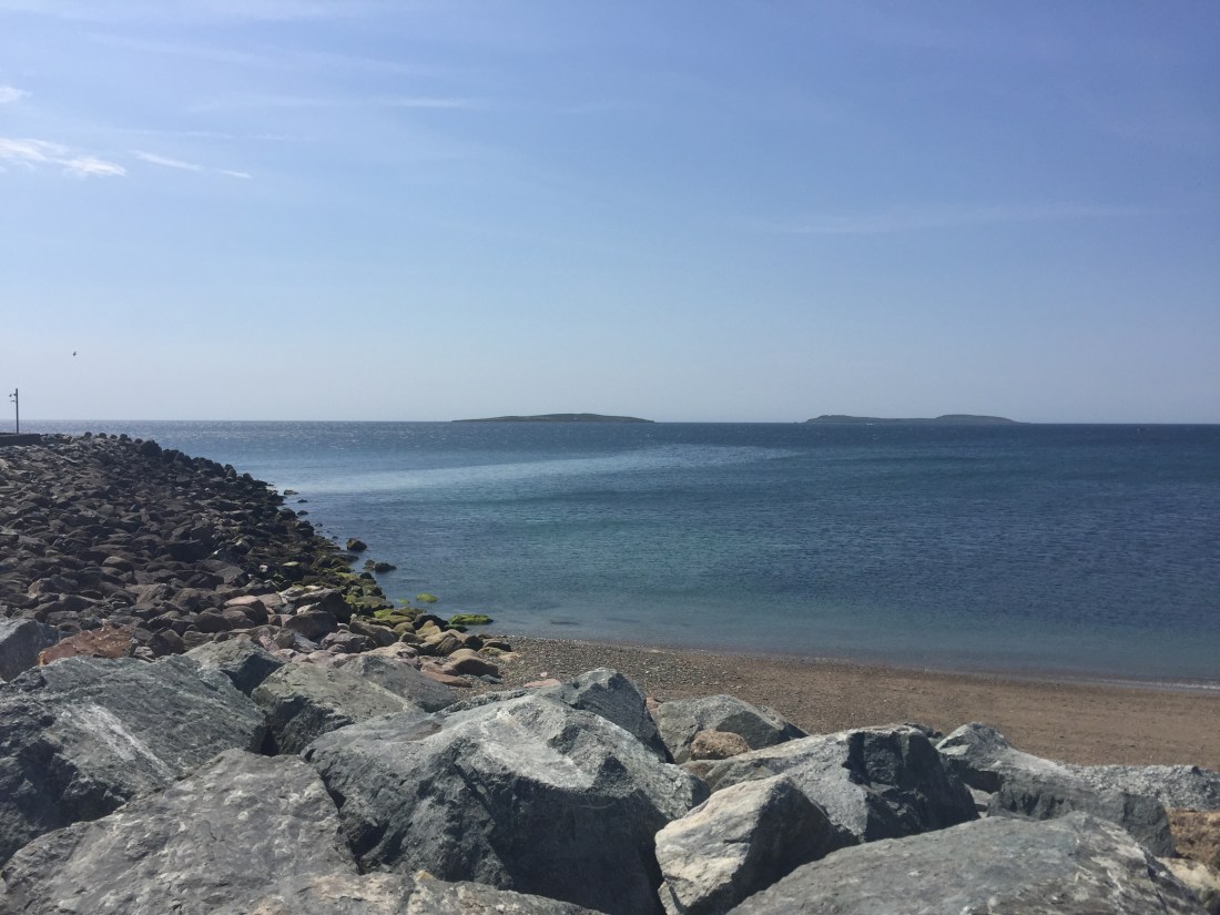
Hello …we are currently moored to a big yellow mooring buoy at Holyhead Sailing Club ( the main marina here was wrecked by Storm Emma ) . We do not have shore power or WiFi and am writing this on my phone!! Can you see Poli Poli in the photo above? She is in the very far distance…we had to get the pink water taxi to bring us ashore!

97CDCFF2-FC50-46C2-8DF2-4A127065F263

Thursday and Friday were rest days in Dublin which I will describe when we have shore power to run the laptop and WiFi! Today Saturday we “sailed” the 59 n.miles from Ireland ( Dun Laoghaire, Dublin ) to the ferry port of Holyhead on Holy Island next to Anglesey.

98D2A413-0F42-4507-8CF7-44D346A68400

The pink water taxi…Poli Poli in the background!

Tomorrow Sunday 8th July Day 41, we hope to complete the so called “Yachtsmans Challenge “ whereby we sail the “Swellies” which are a section of the Menai Straits between North Wales and Anglesey. Wish us well! Set out below is my Saturday evening homework…hope I have done my sums correctly!

E40555F4-83BF-44AD-83C1-EBF2EB9A35F0

Day 39 Sailing Day… Arklow to Dun Laoghaire ( For Dublin ). Wednesday 4th July, 2018.

Up at 6am… a beautiful morning but alas no wind…. to the showers first. We planned to depart at 9.30am when the big tide that runs up and down the east coast of Ireland changes from north to south to the other way… and helps to carry Poli Poli northwards to the big marina at Dun Laoghaire ( and for those uninitiated like me… you pronounce this place as “Dunleary”.

IMG_6007

Photo…. sunset the night before departure. Poli Poli on the Avoco river, Arklow, Ireland.

Various jobs have to be done before setting off…. make sure the water tank is filled, disconnect the shore power, winch handles into their special pockets in the cockpit, the spray hood and cockpit tent should be taken down, all the essential instruments should be turned on eg the two chart plotters, the VHF radio, Navtex, AIS receiver, Sea Me Radar transmitter, Radar etc etc, the main sail furling winch should be set to “out”, an engine check should be carried out… oil dip stick, coolant check, tension on alternator belt, amount of diesel in the fuel tank etc, and most important…the main engine sea cock sea water intake valve should be open, all instrument covers taken off… wind, depth, speed, auto pilot, and chart plotters… and a few more jobs as well. Make sure all the hatches ( windows ) are secured shut and watertight!!

IMG_6011

The nineteen arches of the Avoco Bridge at Arklow, the morning of departure.

Before setting sail you also have to consider what will happen when the boat “heels” ie the whole boat will lean one way or another when the wind is in the sails… the heeling will be countered by the big one ton keel and two tons of solid grounding plate in the bottom of the boat.

So anything left out on a horizontal surface before heeling… ie plates, cups, the electric kettle, toaster, books in shelves, anything on the trays on the table in the saloon, in the two bathroom/toilets…. anything that will move… if not secured will fly across the boat from one side to another when she heels. Sadly sailing folk have been badly hurt when tins of food, plates or saucepans start hurtling across the galley or saloon when the boat is heeled under full sail. So what do we do on Poli Poli?

As a matter of good practice, before we depart we put up one of the lee cloths on one of the long saloon seats. This creates a safe place to store anything that will move when the boat heels….so books from the shelves, first aid kit, all torches from the shelves, kettle, toaster, cushions, trays, bowls of fruit, etc etc…. literally anything that moves. We check that every horizontal surface is clear of any moving object.

IMG_6012

Photo… all ready to go at 9.30am Wednesday 4th July. Poli Poli at Arklow,

The same goes for the two “heads”… soap dish, liquid soap dispenser etc all go into the

sinks. In the two cabins… likewise… all things that can move are placed securely in the centre of the bed at as lower level as possible. It is not like driving off in a car… open the door, get in and off you go. Pre-sail stowage is vital and needs to be thought through.

The mooring lines and fenders will need to be looked at prior to departure… all the three mooring warps ( ropes ) that have secured the boat to the pontoon overnight need to be turned into “slips”… so they can all be let go from the boat… and nobody has to be on the shore side when they are released. Are all the fenders correctly positioned as the boat pulls away forwards or in reverse when she finally leaves? Where is the hull of the boat going to touch the dockside?

What seems a complicated long list of things to do, simply becomes a matter of routine that everybody knows and understands “why”… and of course it is good practice.. and keeps everybody safe and prevents damage to the boat. It does not take long, but we always believe it is a good 30 minutes pre-departure routine well spent.

So having done all the above we slipped our lines at 09.30 hours and set off down the Avoco River in Arklow for the Irish Sea. Once beyond the harbour breakwaters all the fenders and lines are stowed away safely so that the decks are clear.

It was a lovely morning…. still in shorts and tops… plus life jackets of course… as we motored out into the bay which is enclosed by a long thin, curved  shallow bank of rocks called the “Arklow Bank”. This you cannot miss as there are six massive wind turbines …. this morning turning very very slowly, if at all in the south easterly breeze. We went “head to wind” and put up our main sail, just hoping that any available wind would fill it!! The big head sail followed.

The sea surface was a dark blue glassy, oily sheen, not a ripple to be seen. Waves of any description were absent… flat as flat as flat…. very different from the previous day when the white horses and one to two metre waves dominated. So the boat stayed virtually level…. no wind means no heeling!

Sure enough the tide turned at 9.30am and began to help push us northwards to the north cardinal buoy known as North Arklow… marking the top end of the dangerous rocky bank mentioned earlier.

Our route northwards would take us past the small town of Wicklow, the county town just south of Dublin. As was the case yesterday, we did not sail a route too far out to sea… we could view the coastline today very clearly in the early morning sunshine. Wicklow ( meaning the “church of the toothless one”! Work that one out! ) was backed by rolling hilis that merge into the Wicklow Mountains. What struck me was the depth of green… and the varying shapes… conical hills and one called the “sugar loaf” mountain. This lovely landscape continued all the way to Dublin Bay.

So we passed Mizen Head, Wicklow Head, Greystones ( a small town with a harbour ), Bray Head, and finally the red buoy known as Muglins off Sorrento Point. Parts of the coast were steep and rocky in brown merging to grey and black in varying shades of colour, off set with verdant greens above and into the hills and mountains beyond. As we rounded Bray Head, Mike pointed out the bay where he thought that Irish celebrities and stars had set up very posh and palatial homes… eg U2 star Mister Bono! He also owns one of Irelands most famous restaurants/hotel in O’Connell Street, in the centre of Dublin.

An uneventful “sail” … entertainment provided by the passing Irish landscape … working out which towns were which, the names of the mountains in the backdrop, and the wide sweeping bays. We had the occasional AIS target to monitor,,, and empty gas tanker heading south, a massive container ship also heading south and onwards to Antwerp in Belgium and a small coaster… literally hugging the coast coming south to Wicklow.

At 1.30pm …. four hours after leaving Arklow, we entered the huge outer breakwaters of Dun Laoghaire harbour marked impressively by two mini green and red separate lighthouses…. which you could not miss. Fenders and lines had already been put out ready for berthing…. another absolutely essential routine… never ever enter a harbour or marina without being ready!! And on both sides of the boat… as you do not know which side you are docking!

IMG_6017

Photo… Poli Poli with dinghy in the massive Dun Laoghaire marina near Dublin.IMG_6021

Poli Poli at Dun Laoghaire Marina…. top centre, church spire and town centre, white building below is the Royal Irish Yacht Club ( Irish equivalent of the Royal Yacht Squadron in West Cowes, Isle of Wight ). Dun Laoghaire also has two other famous Irish yacht clubs here.. the Royal St. George and the Irish National Yacht Club.


Again there was no help in taking our lines…. but we docked safely in berth ND21 in Dun Laoghaire Marina and tied up with three warps… stern, midships and bow. A really huge 850 berth marina…. lots of lovely boats… but also lots of empty berths.

IMG_6018

Photo…. Poli Poli in Dun Laoghaire Marina, near Dublin. Note the massive breakwater wall in the background. This hides Dublin Bay and the city itself.

Very different and the complete opposite of the small scale long pontoon side on berth of

Arklow or the enclosed, tight little stone harbour of Kilmore Quay. Very different. We are here now for three nights. Our second capital city…. with Dublin the capital city of the Irish Republic not a stone’s throw away next door.

Today’s mileage… 36.6 n.miles, duration 4 and a quarter hours Arklow to Dun Laoghaire.

913.3 n. miles  from Eastbourne our starting point on 27th May, 2018.


Day 38, Tuesday 3rd July, 2018…. sailing day…. Kilmore Quay to Arklow…. another 54 n.miles in breezy conditions.

As agreed with Eric and Margaret on their boat, we actually departed Kilmore Quay harbour at 6.40am…. they were both up and ready! We waved goodbye as we exited the harbour entrance, hoping to see them later in the week in Dublin.

It was a fine morning, sunny with cloudless blue skies…. but there was a “breeze”. For days now the wind has come from the north east… and today was no exception. Yesterday there had been strong winds…. but today Tuesday, it seemed  to have moderated somewhat.

An uneventful passage… after departing Kilmore quay and the two Saltee islands and then having rounded Black Rock and the Barrells east cardinal we headed north. This meant that we were going to be virtually head to wind for most of the voyage. There were not too many options either way…. as to go north we had to carefully navigate in channels between long thin shoals of rocks and some rather large outcrops such as the Tuskar Rock and the Bailies.

Passing Rosslare Harbour on our port side, we had to slow down and change course to avoid a number of big ferries crossing over to the UK…. to Fishguard and Pembroke in Milford Haven. We were travelling at about 8 knots, but the ferries were doing double our speed…. 18 knots minimum. No contest. Not to be messed with!

So even though we had the main sail up, it was virtually motoring all the way. We had planned our departure time with the tidal stream in mind…. and once again we were propelled along by a very strong following tide… for much of the time running at 2 knots. So our best speed was over 8 knots…. and we reached our destination at 1.45pm… just after high tide in Arklow.

IMG_5998

Poli Poli moored on the 100m long straight river pontoon, Arklow, County Wicklow…. the Avoca River.


Arklow is a busy, small town on the banks of the Avoca River, in County Wicklow. We are currently moored on a long 100m river pontoon side on in the Avoca River. Founded by the Vikings in the ninth century, Arklow was the site of one of the bloodiest battles of the 1798 rebellion.

IMG_5999

Mike striding forth…. to the pub! The nineteen arch bridge up river. Very warm!

The town’s close proximity to Dublin to the north, has led it to becoming a commuter town with a population of about 14,000. We walked across the Nineteen Arches Bridge, looking for a place to have a late lunch. We read the that the town was once famous for boat building …. one of Sir Francis Chichester’s Gypsy Moths was built here.

IMG_6002

Looking downstream from the Nineteen Arch Bridge towards the sea… the Avoca river. Poli Poli is on the left hand side, find the tallest mast!


So we are safely and securely on a river pontoon for the night… the breeze has dropped and apart from a French boat… berthing very close to our rear end… all is peaceful. This evening we have seen many rowers speeding up and down in sculls, sixes, pairs and eights.


Total distance for the day… 53.9 n.miles. Duration 7 hours.

876.7 n.miles from Eastbourne.

Tomorrow Wednesday we head for our second capital city …. Dublin. We will depart at 9.30am … this time will give us good tide until about 1300 hrs. The sail to Dublin is a comparatively a short one 36.2 n.miles northwards along the Irish coast.


Day 37 Rest Day in Kilmore Quay, Ireland.. Monday 2nd July 2018.

Another warm day…. even Ireland is experiencing the heat wave and its attendant anticyclone…. although Monday was a very windy day… Force 4 to 5 from the North East.

After a first, big full Irish breakfast at the local seaside cafe… where I did not ask for English Mustard… just mustard!! We toured the little town… just happened to come upon a massive Chandlery… like two Force 4’s put together… but one of the every few where I have left without buying a single thing!!

IMG_5982

Photo above,,, the harbour at Kilmore Quay in Ireland. Centre yacht is the Hallberg Rassey 37 belonging to Eric and Margaret, rafted up to Poli Poli on the inside. You can just see our dinghy on the back.

We noted that many of the houses in Kilmore were thatched…. later that evening, in the pub, I looked at some old historical photos from the 1950’s which indicated that the vast majority of houses were thatched then. A pleasant little place, very neat and tidy…lots of holiday makers, and some brave souls swimming in the Irish Sea off the very clean town beach.

The afternoon was taken up with our newly found German friends Margaret and Eric ( both 82 )… sitting in their saloon on Altrhein ( Hallberg Rassey 37 )…. drinking beer and wine ( they come from Mainz and had lots of bottles of the local Rhine brew Reisling )…and looking at charts, pilot books, and discussing such matters as Brexit, Germany’s exit from the World Cup, and all manner of subjects in a jolly, friendly and humorous way.

The star show of the day was the very sudden  arrival of a huge, brand new looking Southerly 47… a massive boat registered in Jersey. This appeared in the harbour and realising that there was no where to berth, did all sorts of circles with lots of bow thruster noises…. and sorties here there and everywhere to see if he could find a suitable berth.

A couple of gentleman indicated to him that there was a single vacant berth and offered help on the pontoons… for a while the southerly 47 skipper took no notice…. and intent on doing his own thing, nearly ran the boat aground by going behind the main pontoons into the shallows. All manner of people were shouting at him… including myself… I was trying to say that if he reversed in he would make the empty berth. The skipper/owner on the helm ignored everybody.

The wind at this stage had increased to about 25 knots and was blowing the Southerly 47 all over the place. The skipper finally did reverse down the channel…. and then for some inexplicable reason spun the boat 360 degrees missing the transom of Poli Poli by inches. He had decided bow first into the berth…. the crew on board were disorganised… they had already lost an expensive looking large fender over the side… and they did not seem to know what lines to get ready.

The upshot of this was that Mike had to leap onto a motorboat next to where the Southerly 47 was coming in at a rate of knots…. and fend it off from hitting the bow of the motorboat. Very difficult to push away a boat weighing maybe 17 tons!! So they touched. At least six guys… including the 82 year old Eric helped pull the 47 into the berth which was not easy! We did not hear a “thankyou”. Not all Southerly owners are like this…. I hope!

We retreated to the pub where we watched Belgium come back from two goals down to beat Japan 3-2 in the very last minute. The pub audience mainly local Irish folk seemed to support the Belgians. Poor old Japan, they “played out of their skins” but an elementary mistake at the end cost them dear.

We retired early to bed, after arranging our departure at 7am the next morning with Margaret and Eric…. as they would have to get up too… being rafted up on our outside. They would have to move their boat out first, then we would leave the berth and exit the harbour. They would then have our berth on the pontoon…. and go back to bed! Of course!

Day 36, Sunday 1st July 2018, sailing from Neyland ( Milford Haven in Wales ) to Kilmore Quay in Ireland….. with the German Halberg Rassey following!!

We departed the marina at Neyland ( Milford Haven ) promptly at 6am . Erlich and Margaret left first…. and we both made sure that we had disconnected our shore power cables!!! It was a cool, bit cloudy day, with the dawn sun just breaking through.

IMG_5952

Poli Poli …. now very clean… and the German Halberg Rassy 37… before departure from Neyland.

IMG_5955

View of Neyland Marina the evening before departure. So green with all this dryness!

IMG_5962

View of Milford Haven looking west down to the sea… from the Neyland Yacht Club restaurant the evening before departure. Look at the skyline.

It took us and hour and a half at 5-6 knots to exit the long waterway known as the “Haven”…. Erlich and Margaret led most of the way, but we passed them by the huge natural gas tankers unloading their cargoes on the south side of the Haven. There was very little wind.

Milford Haven has two well marked channels in and out… the West Channel is for the big, commercial ships…. oil and gas tankers etc. The East Channel was for us … a smaller one  for leisure craft. At the entrance… a well marked lay out of buoys allows you to depart easily.

Our route would take us due west away from the entrance… but you have to ensure safe passage to the south with a profusion of small islands to the north… Skomer, Skokholm, etc…. I think, famous for wildlife and a multitude of seabirds.  Checking on Wikipedia I note that that around half the world’s population of Manx shearwaters nest on Skomer….plus the largest British colony of the Atlantic  puffin.   Margaret and Erlich followed us at a safe distance.

To begin with the wind was all over the place at various low speeds… so we motored. Noticing later that the wind had settled  to a north easterly… and for us a beam reach… both main and jib sail went up. For at least three quarters of the total journey… the tide pushed us from behind, first to the west and the shipping lanes, then north to the coast of Ireland. This is where “Boatie” is worth its weight in gold. Not only can you plan in advance but you can also check the direction and speed of tide en route. Today the tide was a massive boost to us and we achieved average speeds of over 8 knots.

After passing the islands of Skomer and Scokholm on our starboard side, we came upon an area known as “The Smalls”….. nothing to do with underware… a group of about six rocky little islands… most of them covered with water at high tide. Names like… Hat, Barrells, and Grassholm. Plenty of wrecks laying amongst them too… so we kept well to the south.

Then came the shipping lanes…. first the “up” lane … saw one huge container ship heading for Liverpool and a tanker going to Dublin. After the “up lane” was the TSS … a lane separating the traffic….traffic separation lane as per the English Channel. And finally the “down” lane where there was nothing to see. Certainly not as busy as the English Channel or the Dover Straits… the latter is on average 300 up and down shipping movements every 24 hours… and then on top of that… at right angles 80 cross channel ferry movements every 24 hours. We saw 2 ships in the middle of the Irish Sea!!

From time to time we could monitor the German yacht following us… they were on AIS ( we receive AIS signals but do not transmit our position as explained in a past post). They were roughly 2 miles behind and on a slightly parallel track.

IMG_5966

A photo of the chart table hard paper copy… of the sail from Milford Haven to Ireland. Showing the islands and rock, plus the shipping lanes and the Saltee’s. I don’t actually write directly on the chart… I use a transparent clear plastic cover and use coloured china wax crayons to write. Then I have to rub it all off. Our position is recorded on the paper chart every hour or so…. just in case all the electronic instruments suddenly fail.

Finally we turned off our westwards ( 270 deg ) course….turning north westwards to our final destination… Kilmore Quay in Ireland ( between Waterford and Wexford ). This was a long leg of nearly 30 n.miles over open water. Two sets of dolphins came to see us on this section…. coming close, doing a bit of a display by leaping out of the water… but not coming to the bow to perform at close quarters for our entertainment…. never mind… they were both magnificent interludes in our sail.

And we did sail… the north easterly wind… began to become a more constant and reliable feature…. coming onto the boat between the beam and a close reach position… sorry non nautical folk… basically forward of the middle part of the boat towards the bow…the pointy end! Not the best point of sailing… but good for Poli Poli as we were now averaging over 6 knots under sail. Happy …. the sound of just the bow wave and the rushing water, the wind moving 15 tons at speed in a direction we commanded. Lovely!

A real pleasure…. until reality struck…. on checking the chart calculations I realised we would be getting there too early… low tide at 2,30pm at Kilmore Quay and we might not have enough water to get into the actual harbour. We were now going too fast under full sail… up to 7 knots on a close reach with a strengthening north east wind of up to 20 knots. So we eased in both sails and studied our options.

There had been no phone signal for about 8 hours after leaving the entrance at Milford Haven. Had to wait to get closer to the Irish mainland ( now just a hazy landscape on the horizon ) so that we could phone the Harbour Master at Kilmore Quay and check what the depth would be by about 4pm.

The wind was getting stronger. I saw 25 knots register on the wind speed dial. This is now Force 5 Beaufort Scale, white horses appearing everywhere ( as well as poorly marked lobster pots )…. and the sea state becoming uncomfortable with spray coming over the bow. A faceful of salty water can be like a cold slap in the face! As well as getting wet.

We were approaching the Irish mainland with two small islands on our port side… Great Saltee and Little Saltee. On the VHF radio, emergency channel we had listened to the conversation between a sailing yacht and the Rosslare Coastguard. The yacht had rope wrapped around its propeller and we think the outcome was a rescue by the Saltee bird watching tourist ferry towing him into  Kilmore Quay. So that ended well … in increasing winds and a rough sea.

IMG_5970

Two long flattish islands off Kilmore Quay, Little Saltee and Great Saltee… a lot calmer seascape the next morning.

We finally contacted the Kilmore Harbour Master by phone…. he assured us that if we located the entrance channel and lifted our keel near the harbour, we would get in ok. So in bouncy conditions but with safety lines strapping us to the Jack Stays we put out our six mooring lines and 16 fenders ready for docking.

IMG_5971

The view over Kilmore Quay on the next day… much calmer.

As we came round the northern end of Little Saltee we found the tidal gate of a green and red buoy… located the Safe Water Mark buoy, turned in on a bearing of 007 deg N… ( shown on the chart as a leading line into the harbour )… we were one of about half a dozen yachts and motor boats who had decided it was time to get behind the safety of the big stone harbour walls of Kilmore Quay.

IMG_5973

The narrow entrance to Kilmore Quay on Monday morning… would not want to meet a fishing boat coming out. Big sea going trawlers based here.

We tied up on a small hammerhead pontoon at 4.15pm… 75.8 n.miles from Neyland in West Wales… some 10 hours sailing. At 6pm the village priest did the “blessing of the boats” service…. sadly we were in the local pub. Two pints of lager please!

IMG_5968

We missed it!

However, the Germans had not arrived. Our last position fix was that they were six n.miles astern of us. Just as we were about to step off the boat to go and locate the only pub…. they appeared. Nicky the Harbour Master had said they were now full… so we waved to Margaret and Erlich to come alonside Poli Poli and raft up against us. They were very tired and were more than happy to do so.

IMG_5989

In amongst all the masts… is Poli Poli with the German boat Altrhrein rafted up against us.

A lovely evening meal was had at the Kehoe pub up by the little village church… a special sea food chowder soup followed by Irish steak! Both presented beautifully and with marvellous flavours… bit different to salty sea water! Memorable supper.

A nice small town, large village Kilmore Quay… lots of holiday makers here.

The pub, the church, harbour, beaches and what would have been Margaret’s favourite shop!


Day 35, Saturday 30th June, 2018…. Rest Day in Neyland…..the German connection and then the disconnection!!

Saturday was another “heat wave” type day… dry, blue skies and very very warm. The previous evening, some hours after our arrival a German flagged Halberg Rassey 37 blue and white sailing yacht came in and berthed next door to us. Mike and I raced round to help when we saw it was a couple…. the lady on deck ready with her mooring line and gentleman on the helm. We assisted with mooring up and they were very grateful. They had sailed directly across the Bristol Channel from Padstow in Cornwall to Neyland in Pembrokeshire, West Wales….they said over 70 n.miles, 10 hours and very tiring.

Saturday morning T washed and scrubbed all the salt off the boat following a very nice full English breakfast at the Marina downstairs cafe…. where we sat outside under an umbrella. Mike walked into the town/village of Neyland which was above on the hillside overlooking the marina. He had a special haircut in the barbers there and did some victualling for the boat.

In his absence I noticed the German couple sitting in their cockpit with the big heavy Reeds Nautical almanac and various sets of blue Admiralty tidal stream atlas’s. Intense discussions and note taking were evident. I had previously made conversation with them both…. Erlich and Margaret… and discovered they were enroute to Ireland. They asked me if I knew the way!!!

I offered to come over to their boat and assist. This I did …. so we put away the Reeds ( it weighs a ton ) and the Admiralty tidal stream atlas collection…. sat in their saloon and demonstrated that by using a very simple phone/i-pad app called “Boatie” you could interrogate tidal streams very accurately…. which we proceeded to do.

Having established that they wanted to go to Kilmore Quay in Ireland… we also worked out the optimum time to depart Neyland in order to have as much of the tide pushing you there…. this turned out to be 6am Sunday departure from Milford Haven. It took five minutes… and so they shelved Reeds and the Admiralty in their very nice saloon.

When I first aquired “Boatie” I got the app free… Margaret the German lady had to pay £7.99 to down load it to her i-pad. Still a bargain and an invaluable aid to navigation. The couple offered coffee or beer or both in return. It was boiling hot… so I said maybe later and returned to getting huge salt crystals off the Oxford blue gel coat. What they did tell me though was that they would have to go  to the fuel berth later before 1pm to get diesel for their trip to Ireland on Sunday. I said we would assist their return mooring.

Mike returned and we got the dinghy off the back of our boat… and by pulling it along the sides of Poli Poli, we inspected the hull and managed to get off all the weed that had accumulated around the tops of our two rudders ( remembering the nasty long thin weed we had bought back from the Scilly Isles !).

Returning on deck we noted that the German 37 footer Halberg was slowly reversing out of her berth. Then we heard a huge “crack” noise…. and noticed that their yellow shore power line from the boat to the pontoon unit had not been disconnected on departure. So “snap”… the yellow cable came away from the pontoon unit with half the plastic connector. There were other bystanders who watched in horror too. Erlich managed to stop his boat and the yellow cable was retrieved from the water. A horrible thing to happen to anyone.

At the fuel berth Erlich and Margaret managed to buy a new shore power connector plug …. so he spent the rest of the day in his cockpit rewiring his shore power cable. I give both of them their due, they were in the eighties… so all respect to them. They had sailed all over Europe and Margaret had sailed the Atlantic. Anybody can forget to unplug the shore power on departure. Good on them for sorting it out afterwards!

Saturday ended with a walk along to the Neyland Yacht Club  and a nice meal to finish the day. Back to the boat…. early to bed…. plan was to get up at 4am.. showers etc and depart for Ireland by 6am. The Germans were going to follow us. They had said the previous evening… if they were not up, please bang on the hull !! In the event… they were up and ready to go.