
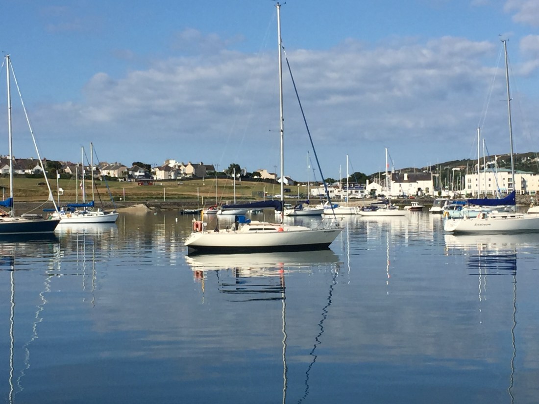
Holyhead Sailing Club…. where we stayed hooked up to a big orange mooring buoy courtesy of the Holyhead Sailing Club for £20 a night and a free water taxi… plus use of the clubhouse, bar, giant TV screen ( England v Sweden second half ), toilets and showers…. were wonderful. We cannot speak highly enough of their welcome and facilities. Marvellous.
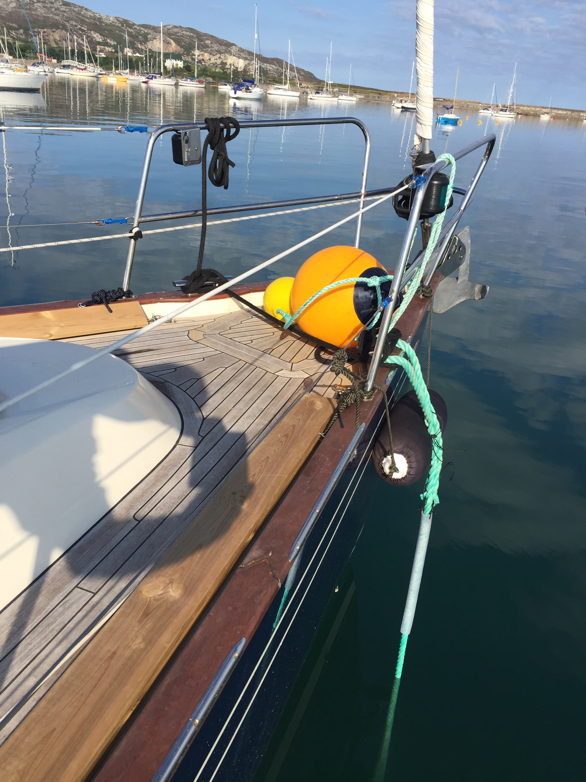
Photo above…. the mooring buoy at Holyhead provided by the Holyhead Sailing Club…. at £20 per night for Poli Poli. The blue fender in a horizontal position stops the green rope from chafing on the Oxford Blue gel coat!
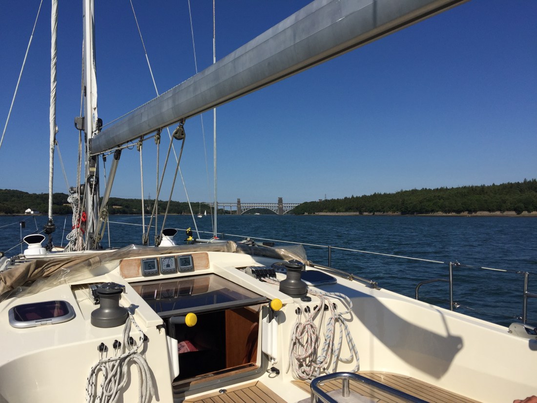
The Holyhead Sailing club building is immediately behind the centre sailing yacht’s fore stay ( furled jib sail ) on the bow. The Met Office describe the sea surface above as “smooth”!
The day’s sail was effectively planned around three serious tidal pinch points.
Firstly, we had to reach the Caenarfon Bar… a major sandbank… no later than 3pm to get across and into the Menai Straits from the southern end.
Secondly we had to reach the Britannia Bridge in the Menai Straits no later than 5pm…. and then in order to access Conwy Marina tidal sill… arrive no earlier than 6pm. So a lot of pre- planning took place before our scheduled departure from Holyhead at 12 noon.
Leave too early and there would not be enough water over the Caenarfon Bar…. and we would have to do big circles out at sea wasting fuel ……so the timing had to be right.
It was 22 n.miles from our mooring buoy on the northern end of Holy Island… which sort of buts onto the island of Anglesey….. to the Fairway Buoy at the sandbank Caenarfon Bar. Once out and round the long, long breakwater wall and into the Irish Sea… what do we find…. a flat, glassy, oily looking sea surface and nil wind. So motoring …. which has been the theme of our passages since the heatwave first arrived over Great Britain.
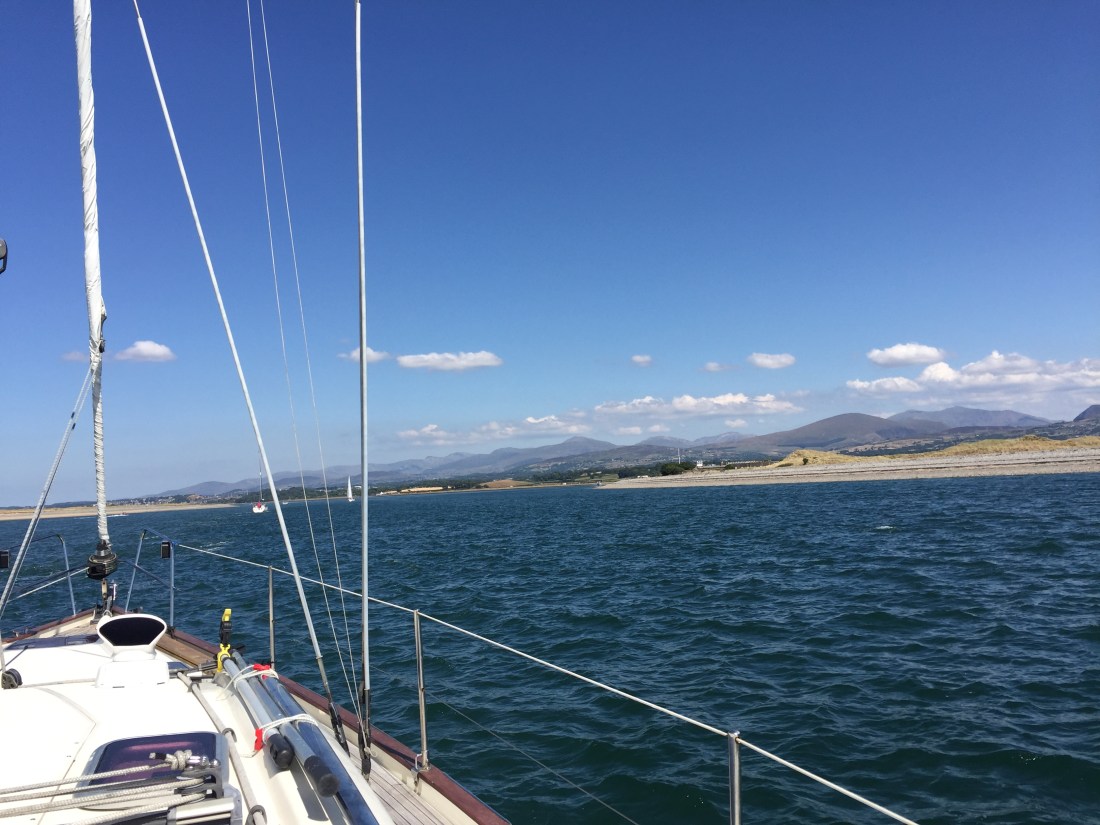
Poli Poli crossing the Caenarfon Bar at about 3pm… the entrance of the Menai Straits are ahead… we are following the two sailing yachts ahead of us. To the right of the photo are the mountains of Snowdonia.
We arrived at the Bar at 3pm…. but we had to slow down earlier in order to do so. Mike helmed Poli Poli into the Menai Straits and past the very historic looking town and port of Caenarfon. As we motored past we observed one of the largest and most imposing fortifications built by the English in Wales…. namely Caenarfon Castle. The town is a Royal town granted that status by Queen Elizabeth in 1963. Caenarfon of course, is also remembered for the investiture ceremony for Charles, Prince of Wales.
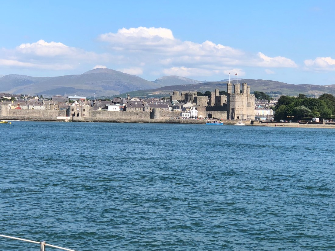
The town of Caernarfon on the Menai Straits seen from Poli Poli motoring North eastwards.
Two early interesting points about the Menai Straits….. one the speed limit of 5 knots…. totally abused by very fast “tripper” ribs roaring up and down accompanied by big flashy motor boats doing well over 20 knots!!
Secondly…. something I have not seen before… but once past a certain cardinal buoy in Caenarfon …. the lateral buoyage system was reversed ie the reds and greens. Normally, if you enter any channel that is buoyed…. greens will always be on the right and reds always on your left! Except that is in the good old USA and parts of North America… it is reversed. Typical.
Anyway just past Caenarfon the reds appear on the right and the greens on the left. Maybe something to do with Caenarfon being a port and small coasters coming into the Menai Straits from the north east side of Anglesey? Never seen this before.
The scenery either side of the Menai straits is very impressive. We passed such small settlements as Port Dinorwic…. a small town on the mainland side of the Straits on a huge arc of a bend. Very impressive from the cockpit of Poli Poli as we passed by at 5 knots. The mainland side of the Menai Straits are set against the magnificent backdrop of the Welsh Mountains….. as we came south from Holy Island we could make out the peaks of the Snowdonia National Park range…. namely the two highest summits of Glyder Fawr at 999m high and just jutting into the base of white fluffy clouds to the south west, Snowdon or Yr Wyddfa at 1,085m high. A magnificent sight in the perfect visibility of a blue sky with only fair weather clouds occasionally butting in.
We reached Port Dinorwic at about 4.30pm….. a bit too early… so we slowed down to 4 knots and took stock, thus allowing a smaller white sailing yacht ( motoring ) to overtake us…. as well as a couple of “tripper” orange ribs which went thundering past. We needed to be at the Britannia Bridge just after 5pm. Why?
The section of the Menai Straits …. between the Britannia Bridge and the newer Menai suspension Bridge are known as the “Swellies” and this short part of the Menai Straits has a quite fearsome reputation…. if you get your timing wrong. The Swellies is a stretch of water which is widely known for its difficulty in safely navigating its shallows, shoals and huge underwater rocks…. due to whirlpools and surges. These are the result of the big tides washing around the island of Anglesey at different speeds.
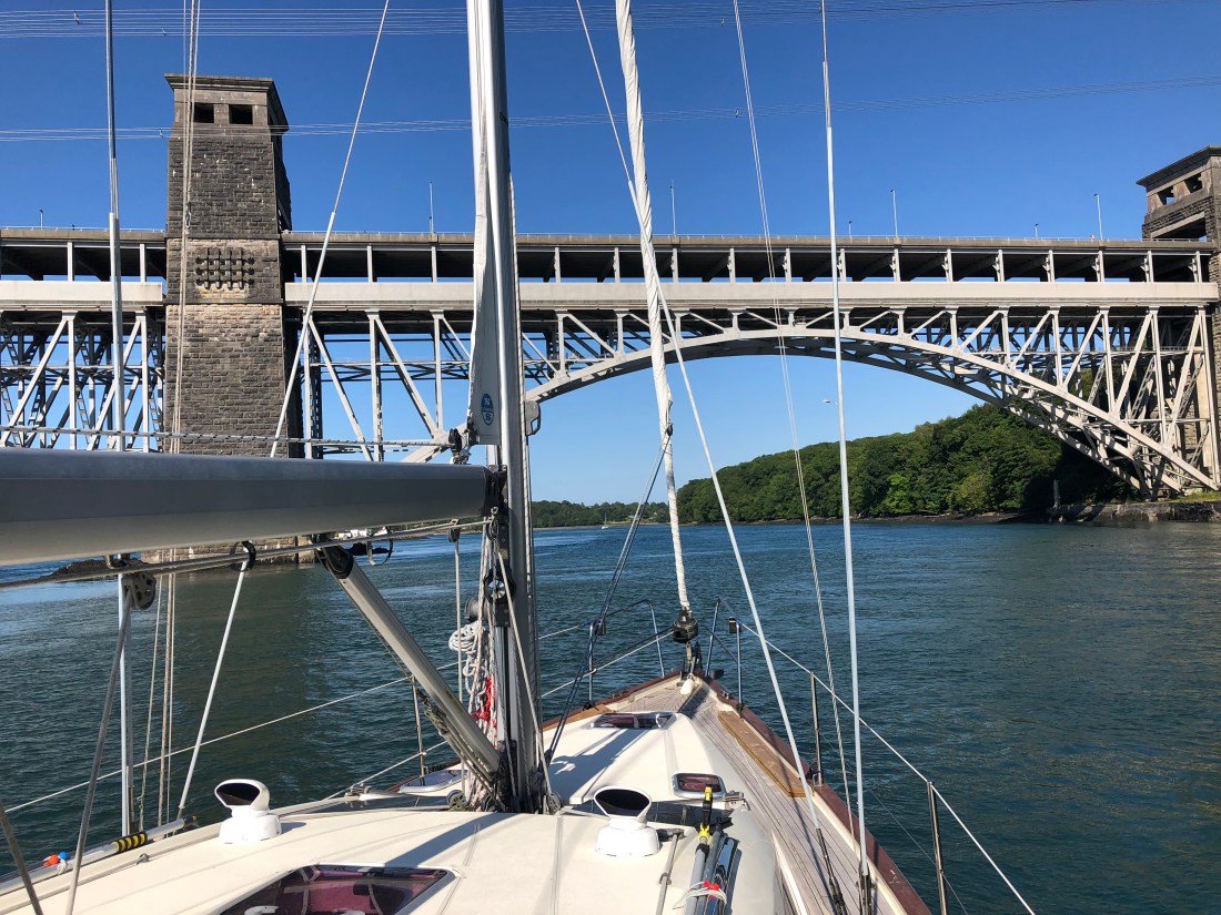
Poli Poli “pausing” before the Britannia Bridge, in the Menai Straits…. just before 5pm… waiting for “slack high water” to occur.
The “Swellies” was the site of the loss of the naval training ship HMS Conway in 1953 and other maritime disasters which have resulted in a loss of life over the passage of time. Most of the sailors standard reference works such as the almanacs Reeds and the Cruising Association plus the various pilot books…. paint a very difficult and hazardous picture of passage making through the Swellies. If you read the advice, if you then mull it over…. you would never do it… one pilot book mentions…. getting the timing wrong… “it is as if someone has pulled a switch”…. that you will be faced with an incoming tide of great force.
So we planned and worked out the best time to go through the Swellies. The advice is to approach the Britannia Bridge at slack high water. You then have to work out when this occurs… by reference to high tide times at Dover and Liverpool. So Swellies slack high water occurs at HW Liverpool minus 2 hours and minus 2 and a half hours at HW Dover. This calculation gave us 5pm to 5.50pm…. with others saying “better to be early than late”…. very difficult to abort once you are between the two bridges.
With some apprehension, Poli Poli was steered through the centre of the mainland arch of the Britannia Bridge. Mike looked up in trepidation…. not worried about what menacing forces lay the other side …. more worried about our air draft and the top of the mast clearing the bridge. It was near high water so it was an issue. The charts stated that the air draft of the Britannia Bridge was 27.4 metres, the air draft of Poli Poli is 20 metres but not accounting for the wind-x and VHF whip aerial which extend for possibly another metre and a half. It looked close as we both looked up!!
We crossed into the Swellies at 4 knots speed, following to the letter the various navigational instructions we had so diligently absorbed from almanacs and pilots… “stay to the right”, “keep over”, “find the passage between the white cottage and the cardinal mark on Swelly Rock “…. “steer 047 deg between the pyramid after passing under the bridge to a mid point between Price’s Point and the Swelly Rock”… and so forth.


I had committed this to a sketch diagram on a piece of A4 paper…. which, as I was concentrating on the visual ahead, I did not have time to refer to. It was stuffed in my back pocket!The black and yellow cardinal mark was very evident…. so to the right we kept our course and headed for Swelly rock. Being near high water, the vast majority of the big black rocks were covered …. except Gribben Rock on which is the very conspicuous white cottage and Swelly Rock in the distance.
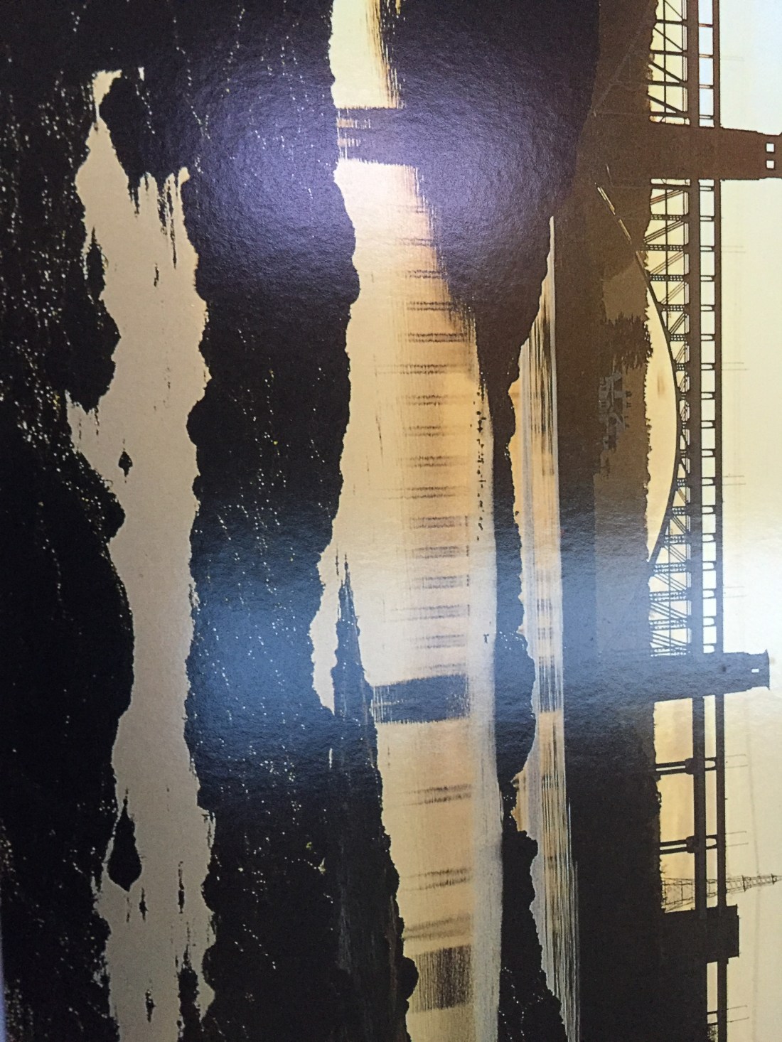
This is what the Swellies look like at low tide. Please turn pic on side.
What I did notice though… that even though it was slack water…. dark blue if not black and menacing…. the surface in many areas was in circular motion….these were the whirlpools and tidal eddies. Our passage took us passed these.
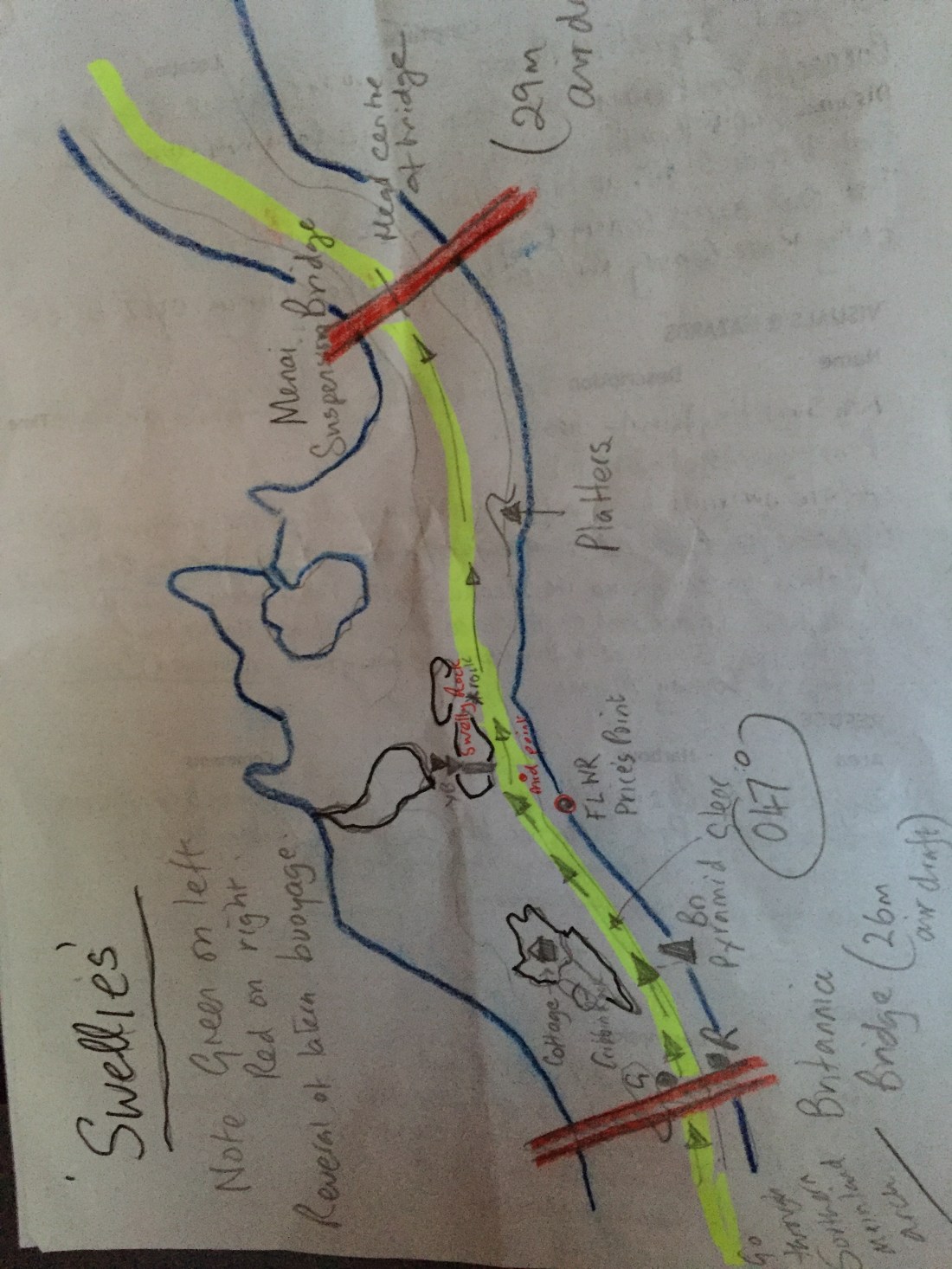
My annotated sketch map of the Swellies..again please turn on side!


With some relief we exited the section between Price’s Point and Swelly Island and headed for the sanctuary of the middle part of the huge Menai suspension bridge…. passing the infamous rocks ( now covered ) known as The Platters. The entire passage took no more than 20 minutes!! Job done…. objective achieved. Tick off the “Swellies”…. along with the Alderney Race, the Portland Bill inner passage, the Swinge on the west side of Alderney…. and one or to others.
Mike helmed north eastwards past Bangor on the mainland side, and the very pretty town of Beaumaris on Anglesey, a rusty old pier thrusting out from Bangor…. all the way to Puffin Island ( we looked but saw no puffins )…. then across Conwy Bay to the fairway plastic buoy marking the approaches to the River Conwy.
After a significant number of red and green buoys ( on the normal side now )… following a meandering channel into the town of Conwy, we moored up safely at the marina…. having crossed a very specialised tidal sill… one I had not encountered before… on a traffic light system… at 7.30pm. We noted that the Mullberry Pub overlooking the marina… was thronged with folk… Sunday evening in the fading sun. A long day…a near eight hour passage…. crossing the Caenarfon Bar and transit through the Swellies.
Holyhead to Conwy via Caenarfon and the Swellies… 51.5 n.miles.
1,021.1 n.miles from Eastbourne. 2,000 n.miles to go!

Very instructional Toby! Reminds me of Portillo’s train journeys. Could be a best seller, set against a round Great Britain trip 100 years ago and another one in 100 years time!
Pleased the weather has been kind to you. You could have had very disruptive and damaging storms. Nice to hear about your observations of the many places that have taken me a lifetime to visit. Field trips to the Welsh Coast, Anglesey, Snowdonia, the Lake District, and so on. Must be fabulous in dazzling sunny weather. Watch out for the sun burn and wind burn though…. Really enjoying your blogs. Well worthwhile. Carry on No.1
LikeLike